P 230 (LY1478)
P 230
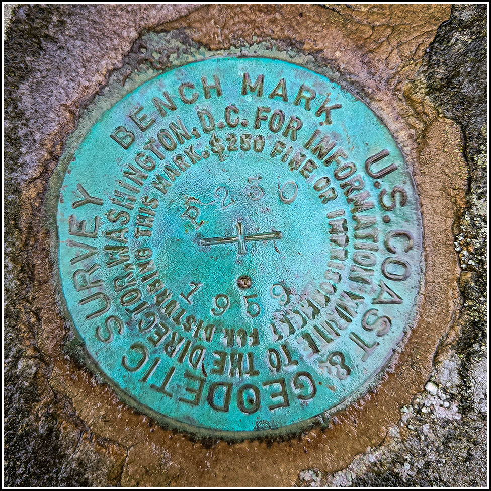
Spatial/elevation data
| Coordinates | N 41.090465° W 75.961255° |
| Elevation | 1336.51 ft. |
| Location | Pennsylvania
Luzerne County Freeland Quad |
Mark description
| Type | Bench Mark Disk |
| Setting | Boulder |
| Monumented | 1959 by NGS |
| Description (NGS) | NGS Datasheet |
Narrative and photographs
I was a few minutes early for breakfast at the Monks house before our Annual Death Hike, and as I exited the highway it occurred to me that there should be an NGS benchmark somewhere just north of where South Mountain Road intersects Blue Ridge Trail. I would be traveling south eventually, but this time I turned left (north) and drove slowly along the road, just hoping I might spot the mark. Luck was on my side this morning, as I glanced over at a conspicuous rock and spotted, on a smaller rock next to it, a bright blue benchmark disk! I found a nearby place to pull off the busy road and made an easy recovery of the mark. The disk and rock are in good condition. I made a note of the utility poles nearest the mark (they have been renumbered since the mark was set, and both poles I refer to are on the same side of the road as the mark).


