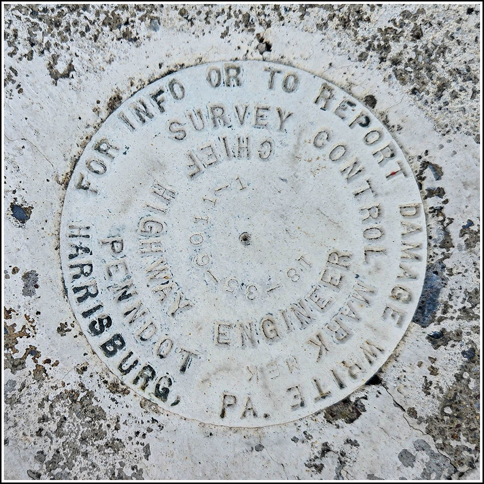
18-35-6011-1
18-35-6011-1
Spatial/elevation data
| Coordinates | N 41.399581° W 75.65227° |
| Elevation | Unknown |
| Location | Pennsylvania
Lackawanna County Scranton Quad |
Mark description
| Type | Survey Control Mark |
| Setting | Concrete Bridge Sidewall |
| Monumented | 2018? by PennDOT |
| Description (PennDOT) | Unavailable. |
Narrative and photographs
After yesterday’s fun excursion to the PennDOT mark set in the Linden Street bridge, I figured I would head in the other direction this evening and try to find another PennDOT mark. I wasn’t sure what to expect since nothing was visible on the street view, and the bridge at this location was replaced within the last 10 years. But the latest recovery on PennDOT PAMS was supposedly from earlier this year, so I thought it was worth a try. That recovery note also mentioned that the mark had been painted the same color as the bridge, which was helpful because initially I walked right past it. It blended in so well! But a more careful look brought me to the mark. It is in good condition on the southern sidewall of the southwest end of the bridge.
