Z 229 (LY1377)
Z 229
Spatial/elevation data
| Coordinates | N 41.392535° W 75.663329° |
| Elevation | 851.18 ft. |
| Location | Pennsylvania
Lackawanna County Scranton Quad |
Mark description
| Type | Bench Mark Disk |
| Setting | Rock Outcrop |
| Monumented | 1959 by NGS |
| Description (NGS) | NGS Datasheet |
Narrative and photographs
Finally! After eluding me (and others, apparently) for decades, this mark has finally been found. And it was only through a series of random choices that brought me to this spot tonight. My goal for the evening’s walk was to search for the two PennDOT marks on Stafford Avenue near Log Road, both of which I found. Rather than walking straight back to my car, I then decided to explore Log Road, which is a peaceful single-lane road that I thoroughly enjoyed strolling along. Initially I’d planned to take Schmidt Court out to Maple Street, which would put me closer to Crown Avenue and eventually my vehicle. But I was enjoying the lane so much that I followed it to its end at South Irving Avenue.
Hmm, I thought as I passed a defunct business called Laminations Inc. This looks familiar. Could I be close to the intersection of South Irving and Maple Street, where I’d looked for that elusive benchmark a few times? Why yes, I was right there! I saw the “cliff” rising above me.
If I couldn’t find it in November I’d have no chance in June with all the vegetation, I figured, but might as well take a quick look since I’m already here. I didn’t see anything on the obvious ledges that I’d already checked in the past. Oh well. Might as well continue climbing up the slope and making my way along SOuth Irving Avenue, as many others have apparently done, or so indicated the path worn into the cliff.
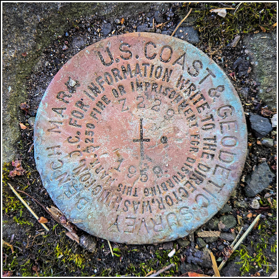
And wouldn’t you know it, in an outcropping of bedrock near the top of the cliff, I happened to look down and spot the mark! I could hardly believe it. I must have looked here before, at least twice on previous excursions. The mark and ledge were relatively clear of debris and overgrowth, so I have no idea how I could have missed it before unless someone had specifically uncovered it, or it had happened naturally due to heavy rain. I have no idea; I just know that I was so thrilled to have finally found it!
The scaled coordinates on the datasheet are over two thirds of a mile away (straight-line distance), so I will submit a correction. The BM indicated on the topo map is in the correct spot, however. The disk itself has been “shaped,” either intentionally or otherwise, to the contours of the bedrock it’s set into, but it isn’t damaged in any way. It is fully legible and set solidly in the ledge.


