TT 7 K
TT 7 K
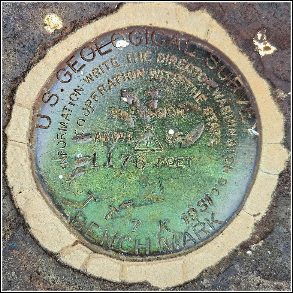
Spatial/elevation data
| Coordinates | N 41.754027° W 75.80743° |
| Elevation | 1176.391 ft. |
| Location | Pennsylvania
Susquehanna County Montrose East Quad |
Mark description
| Type | Bench Mark Disk |
| Setting | Stone Foundation |
| Monumented | 1931 by USGS |
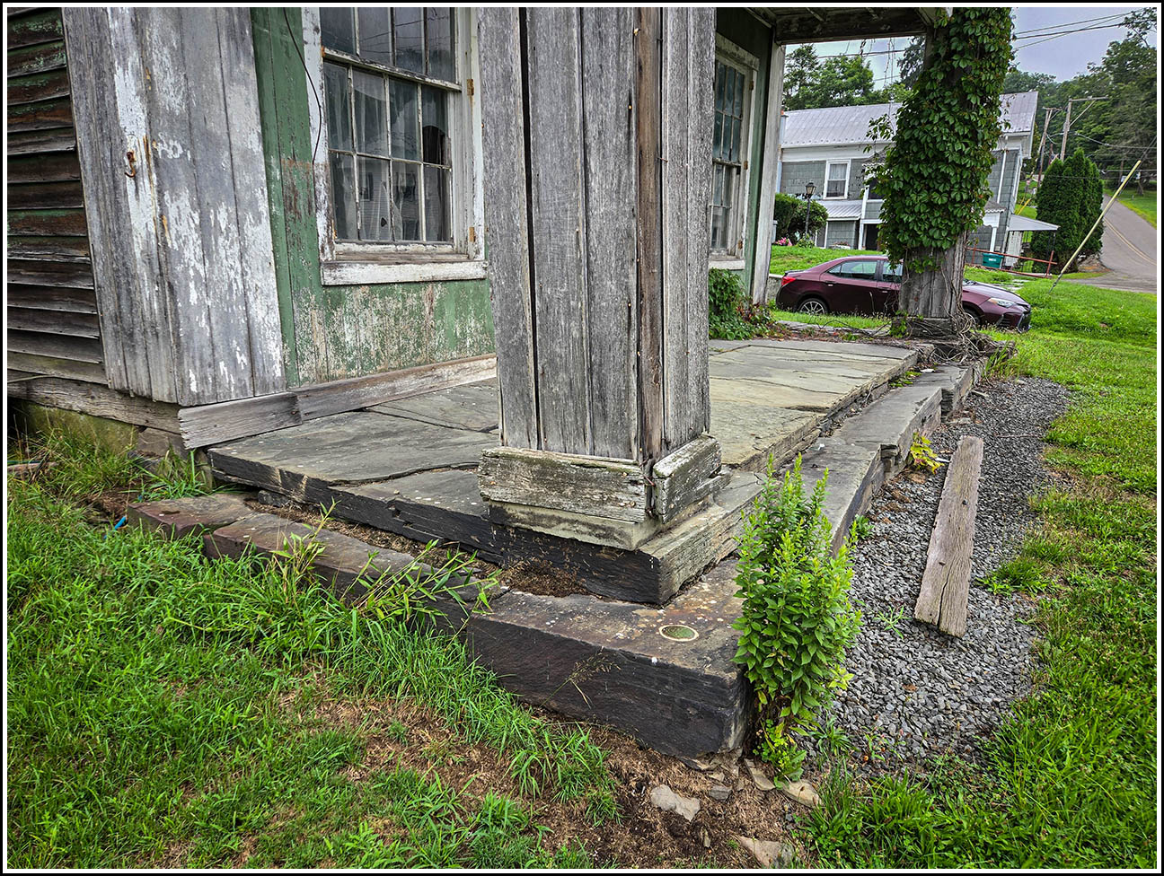
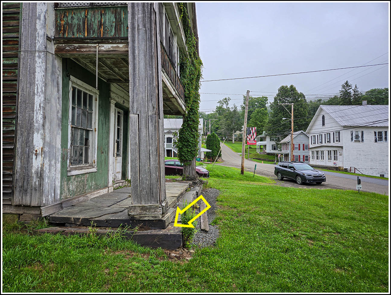
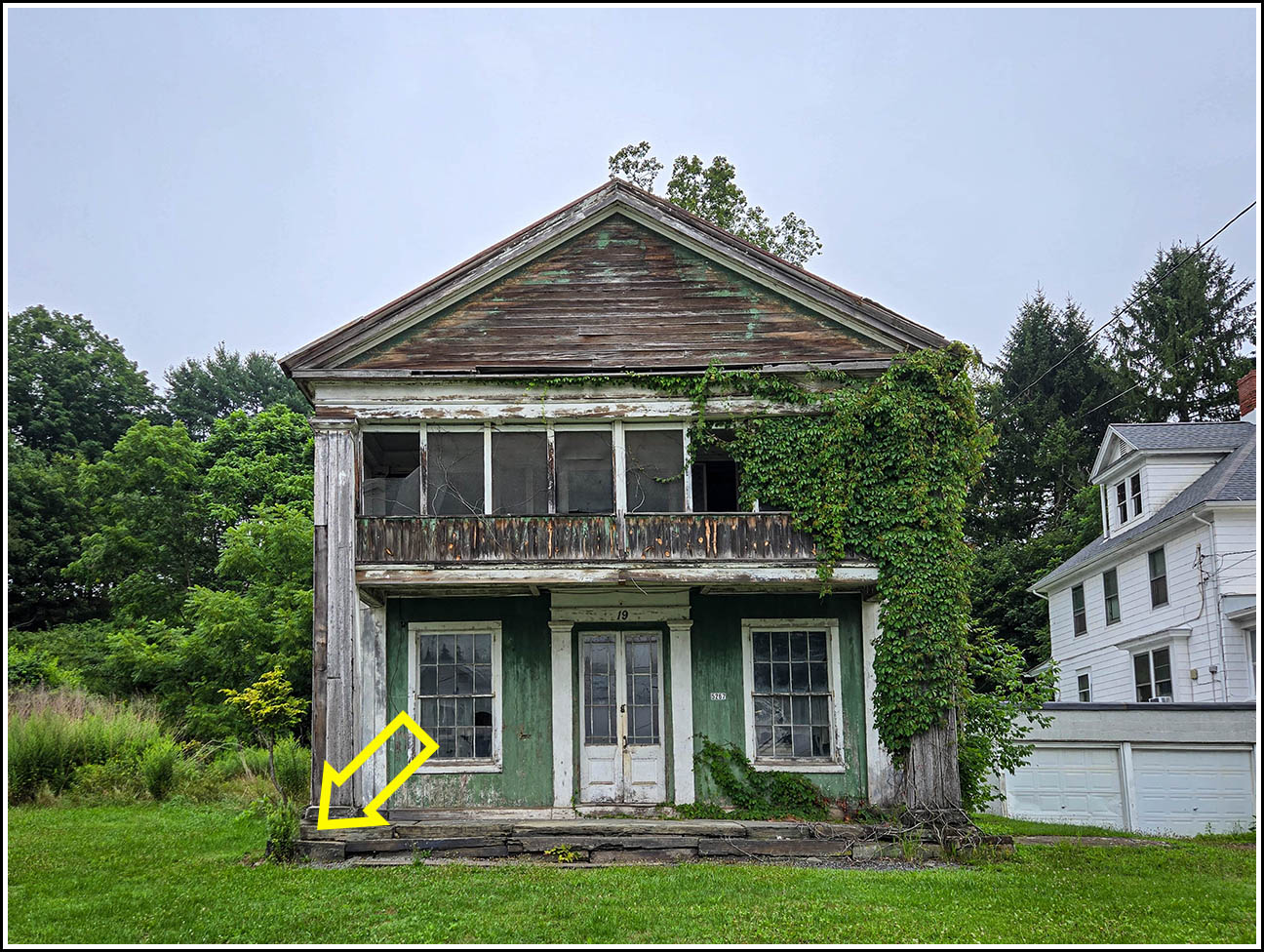
| Description (USGS) | Brooklyn; 50 ft N. and 35 ft W. of junction of Main and Maple Streets; at SW. corner of stone porch of post office and store of L. S. Ely; in foundation stone; standard tablet stamped “TT 7 K 1931 1176” |
Narrative and photographs
This morning Dad and I went on our nearly-annual pilgrimage to the town of Montrose for their blueberry festival. Dad picked me up and we were just getting underway when he asked if I knew of any benchmarks along our route. “Well,” I said, “I’m pretty sure there is (or was) an interesting mark in Brooklyn that should be easy to find, if it’s still there.” “We’ll do it!” he said.
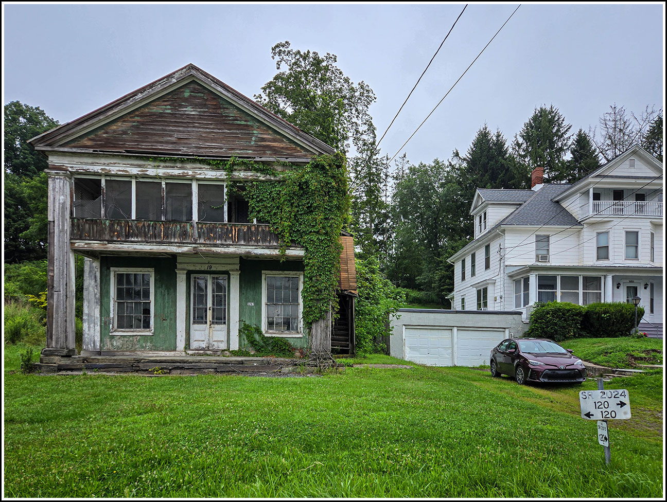
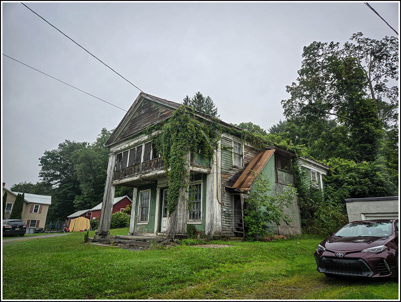
Our route took us through Hop Bottom and then into Brooklyn, where we turned onto Maple Street. I could see the old store building come into view as we neared the intersection with Main Street. The old building is flanked by houses on either side, so I wasn’t sure if anyone would give us a problem while we were parking and poking around, but fortunately no one bothered us. We pulled over right in front of the old building, and I got out to investigate. It was an immediate find! I gave Dad the thumbs up, and then documented the mark as usual. Dad was familiar with the shop owner’s name, Ely (pronounced Ee-lee), and apparently it is a common name in this town and the surrounding towns.
I thought there was a chance that the reference mark could still be found, because a concrete headwall in the right location is visible on Street View. But when we drove down the Main Street hill to get an in-person look at it, I could see that there was a newer concrete barrier placed on top of an older concrete headwall at the culvert. So if the chiseled square is still there, it’s probably on the corner of the lower chunk of concrete that’s covered by the newer barrier segment. (And even if it were on the upper piece—unlikely because it looks significantly newer than 1931—the eastern corner is chipped off.)
Next up was the main attraction of the day: the blueberry festival in Montrose. While I was investigating the local history books at the Susquehanna County Historical Society, I noticed one called A History of Brooklyn, Susquehanna Co., Penn’a: Its Homes and Its People by E. A. Weston. I flipped through it, but at the time, I didn’t spot any references to the store or the Mr. Ely mentioned in the description.
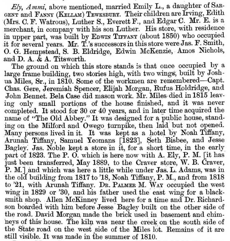
When I came home, I was excited to find A History of Brooklyn available on Google Books, and even more excited when I realized it contained not only a mention of L. (Luther) S. Ely (p. 60):
Ely, Luther S. is engaged in the mercantile business with his father, and occupies the building just west of the store. He married Lottie, a daughter of Joseph Oakley, and they have a daughter, Edna.
but also a history of the buildings on the site of the store/post office, within the entry for Luther’s father Ammi (p. 58; see the gallery below).
| Designation | Status | Condition | Image |
|---|---|---|---|
| TT 7 K RM | Not Found | Unknown (Not Found) |

|