TT STA NO 24 B
Spatial/elevation data
| Coordinates | N 41.34858° W 76.30069° (estimate) |
| Elevation | 2242.928 ft. |
| Location | Pennsylvania
Sullivan County Red Rock Quad |
Mark description
| Type | Bench Mark Disk |
| Setting | Boulder |
| Monumented | 1929 by USGS |
| Description (USGS) | Ricketts, 3.7 mi S. of, along State Highway 487; at private rd. W. to Ganoga Lake; 20 ft NW. of rd. forks; 15 ft N. of rd. W.; in embedded boulder; standard tablet stamped “IT STA NO 24 B 1929” |
Narrative and photographs
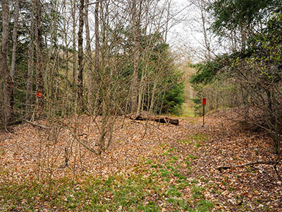
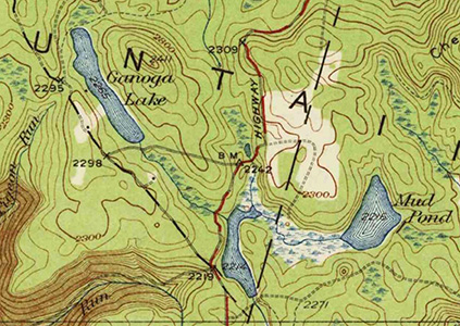
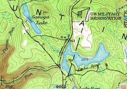
Of the four marks I failed to find today, this is the one I’m most interested in returning to search for. I didn’t realize this until later, when I checked the old topo maps, but Route 487 in this area was straightened out at some point between 1934 and 1953. I was curious why the description says “along State Highway 487” when the coordinates are a few hundred feet west of the highway. I wasn’t sure if they meant “along the highway” literally, but it turns out they did. There were once several rather sharp turns along Route 487 in this area, and the benchmark was located at the point where the highway swung back to the south and the road to Ganoga Lake continued west. Both roads are still evident. With more time to explore, I have hope that this mark can be located. I don’t see any particular reason why it would be gone.


