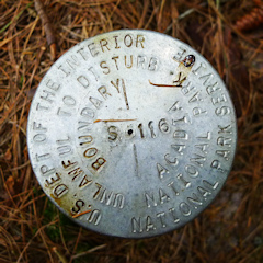
S 116
Spatial/elevation data
| Coordinates | N 44.31517° W 68.24982° |
| Elevation | Unknown |
| Location | Maine
Hancock County Seal Harbor Quad |
Mark description
| Type | Boundary Monument |
| Setting | Pipe Cap |
| Monumented | Unknown by National Park Service |
Narrative and photographs
While walking on the Seaside Path on this misty Thursday, Rich and I found an NPS boundary marker (S 114) right alongside the trail. Thinking that the boundary probably crossed the trail at this point, we looked into the woods for signs of another marker along the boundary line. East of the trail and about 50 yards into the woods, we spotted another orange witness post! But when we arrived at the post, there was no disk to be found. There was simply a piece of rebar stuck in the ground with some flagging tape tied to it. There was a piece of flagging tape tied to a nearby tree, too.
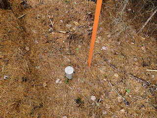
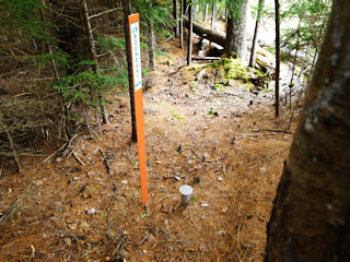
While it’s likely this is a boundary point of some kind, without any designation we chose to move on and see if we could find anything else. I headed south into some mucky woods along a fence surrounding a private stables and immediately spotted another orange witness post! This one had a disk, set on a pipe sleeve, at its base. The disk is in good condition and is stamped S 116 (so does that mean the rebar at the corner marks S 115?) We didn’t trace this particular line any further, but I’m sure there are more boundary markers to be found in this area.


