R/US
Spatial/elevation data
| Coordinates | N 44.320516° W 68.25285° |
| Elevation | Unknown |
| Location | Maine
Hancock County Mount Desert Quad |
Mark description
| Type | Unspecified Disk |
| Setting | Concrete Post |
| Monumented | Unknown by Unknown Agency |
Narrative and photographs
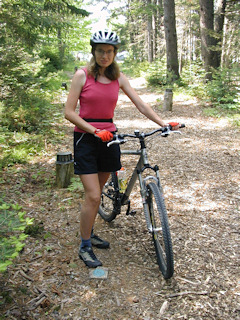
Aaron still can’t believe he survived a 25 mile bike ride! I didn’t drag the bike all the way to Maine for nothing; we were determined to complete at least one day-long bike ride in Acadia. Sunday was the day. After fueling up with some Sunday special pancakes at our usual breakfast haunt, Aaron went to the rental shop to pick out a bike for the day while Rich and I returned to the hotel to hop on our own bikes. Soon we met up again and were off on the carriage roads.
We’d hardly begin when from behind us came the most incredible roar—old women on bikes taking the carriage roads by storm! Uh-oh, they’re from the cruise ship. That means … yep, first hill and they all stop dead and fall sideways off the bikes. Rich, Aaron and I silently shift into lower gears and just glide on by, smiling. (Yeah, that part was for you, mom!)
Our next encounter was with another slow and crusty creature—a snapping turtle right in the middle of the road. (He was so perfectly positioned we had to wonder if he’d been placed (a la “Cue the Deer!”) for the benefit of the cruisers.) We naturally had to spend some time taking photos and acquainting ourselves with his funny little snout and claws. I looked but did not touch!
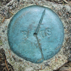
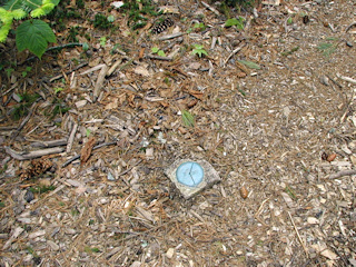
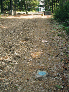
After a lovely nap on the shore of Eagle Lake, lying on a rock slab with our feet in the water, we continued on the carriage roads, winding our way around to Jordan Pond House where a lovely lunch of popovers, jam and tea awaited us. While riding the path leading in toward the House, I happened to spot a disk in a concrete monument. A closer look revealed that it was not a benchmark but some kind of boundary monument, an angled cut through the center, “R” on one side and “US” on the other. At the time we surmised that it may have marked a boundary between Indian and US land, or between private and public property. Further research has turned up nothing other than it may have had to do with Rockefeller. (The popovers were well worth the wait, the ride, and their reputation, by the way. I recommend them!)


