WISCASSET CONG WHITE SPIRE
Spatial/elevation data
| Coordinates | N 44.004055° W 69.668082° |
| Elevation | Unknown |
| Location | Maine
Lincoln County Wiscasset Quad |
Mark description
| Type | Landmark/Intersection Station |
| Setting | Church Spire |
| Monumented | 1934 by NGS |
| Description (NGS) | NGS Datasheet |
NGS recovery information
Descriptive text
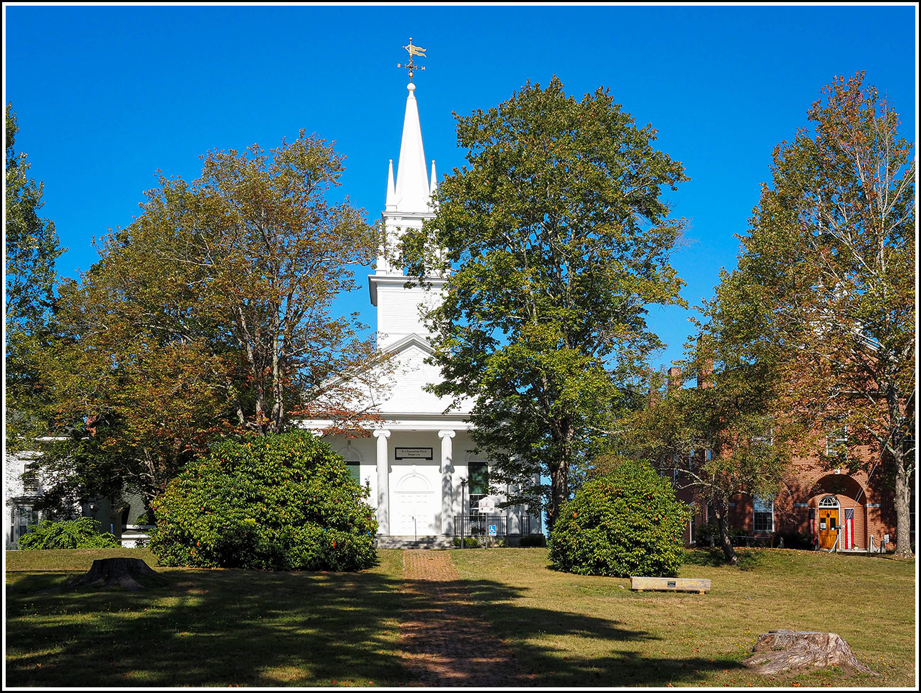
Recovered in good condition atop the First Congregational Church. According to the “Museum in the Streets” sign at the site, the building was first erected in 1767 and served as a meeting house. The structure was rebuilt in 1840, and became the First Congregational Church in 1907. The weathervane still sits atop the spire, as described in the 1934 observation note.Narrative and photographs
After our exciting recovery of H 17 on the old customs house building, Rich asked if there were any other benchmarks nearby. The only ones on the map that might be within walking distance were two church spires that served as landmark stations. These are generally not that exciting from a recovery standpoint because NGS no longer actively uses them for surveying purposes, but they are often interesting from a historical standpoint. The first one we found was the white spire atop the First Congregational Church.
According to the “Museum in the Streets” sign at the site, the building was first erected in 1767 and served as a meeting house. The structure was rebuilt in 1840, and became the First Congregational Church in 1907. The weathervane still sits atop the spire, as described in the 1934 observation note.

