DUCK HARBOR MOUNTAIN
Spatial/elevation data
| Coordinates | N 44.0231° W 68.649216° |
| Elevation | 315 ft. |
| Location | Maine
Knox County Isle au Haut West Quad |
Mark description
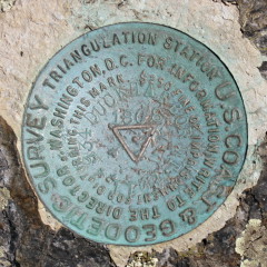
| Type | Triangulation Station Disk |
| Setting | Bedrock |
| Monumented | 1868 by NGS |
| Description (NGS) | NGS Datasheet |
NGS recovery information
Descriptive text
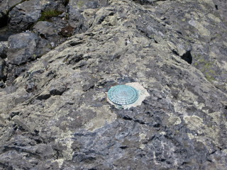
The station and both reference marks were recovered in good condition. The marks are located on Duck Harbor Mountain in Acadia National Park. The station was reached via the Duck Harbor Mountain Trail. Handheld GPS WAAS-corrected coordinates for RM 1 are 44 01 23.4(N) 068 38 57.1(W). Handheld GPS WAAS-corrected coordinates for RM 2 are 44 01 23.3(N) 068 38 57.4(W).Narrative and photographs
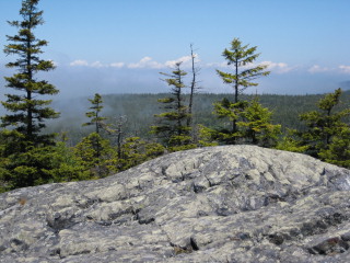
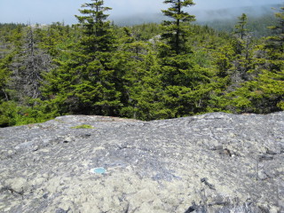
Rich and I spent the day at the far reaches of Acadia National Park—the section of the park on Isle au Haut. It’s quite a haul to reach the island, involving a drive to Stonington and then a ferry ride to Isle au Haut Town Landing. Along the way we spotted two landmark stations from the ferry (the lighthouse and the church spire). But the main goal of today’s hike—other than to thoroughly enjoy the exercise and all the scenery around us—was to attempt to recover the DUCK HARBOR MOUNTAIN triangulation station. We hiked the Duck Harbor Mountain trail and found it to be a beautiful, moderately challenging trail with some rock scrambles and exposures on relatively sheer cliffs. At the summit we were above the fog, so we were able to enjoy the warmth of some strong June sunshine, but the views weren’t as expansive as they would be on a clear day. Still, the closed-in feeling and the fact that we had the entire mountain to ourselves made the whole experience particularly special and intimate. All three disks were in excellent condition and were found easily using the historical descriptions.
| Designation | Status | Condition | Image |
|---|---|---|---|
| DUCK HARBOR MOUNTAIN RM 1 | Recovered | Good |
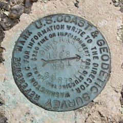
|
| DUCK HARBOR MOUNTAIN RM 2 | Recovered | Good |
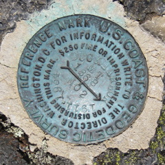
|
