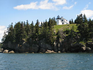
BEAR ISLAND LIGHTHOUSE
Spatial/elevation data
| Coordinates | N 44.283417° W 68.26995° |
| Elevation | Unknown |
| Location | Maine
Hancock County Southwest Harbor Quad |
Mark description
| Type | Landmark/Intersection Station |
| Setting | Lighthouse |
| Monumented | 1934 by NGS |
| Description (NGS) | NGS Datasheet |
NGS recovery information
Descriptive text
Recovered in good condition.Narrative and photographs
Rich and I spotted this lovely lighthouse while on a nature cruise that took us past it and the Bunker Ledge Monument (PE1784) to Islesford and then eventually into Somes Sound. The lighthouse is not publicly accessible; it’s best viewed from the water.
The present structure was built in 1889 and served as an active Coast Guard light station until 1982. It was relighted in 1989 by the Friends of Acadia and now operates as an active private aid to navigation.
