LOP
Spatial/elevation data
| Coordinates | N 44.226833° W 68.364733° |
| Elevation | 39 ft. |
| Location | Maine
Hancock County Bass Harbor Quad |
Mark description
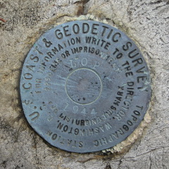
| Type | Topographic Station Disk |
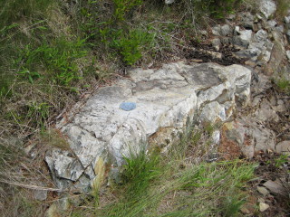
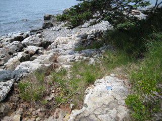
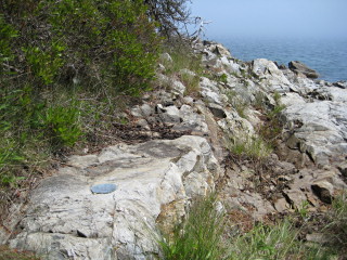
| Setting | Rock Outcrop |
| Monumented | 1944 by NGS |
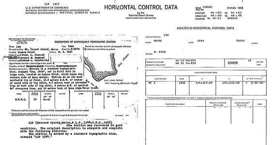
| Description (NGS) | NGS Datasheet |
NGS recovery information
Descriptive text
Recovered in good condition.Narrative and photographs
Most of the topographic stations in this area are on practically inaccessible islands (we don’t have a kayak—or a helicopter!), so we haven’t been able to recover many of them. LOP looked like a strong possibility, though, and one I’d been interested in for a few years already. Today, Rich suggested that we give it a try.
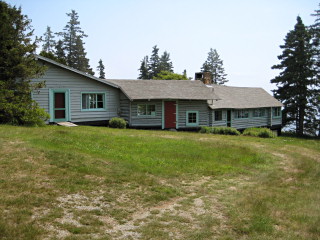
Driving south on Lopaus Point Road, we could tell that we might have an issue with all the private property nearby. In fact, there were so many “private drive” signs that we began to feel uncomfortable, so we parked the car and walked the remaining half-mile or so toward the coordinates. While we walked, a woman in a Subaru passed us, but said nothing. When we reached the end of the road we came upon a neat house that looked like three cabins strung together. The Subaru was parked there. We approached the cabin to ask permission to search for and document the mark.
The woman answered and immediately called a man to the door. He was extremely kind and pleasant, and he had no problem with our going to document the mark. As we’ve found with so many landowners, he was aware of the survey mark but had no idea of its purpose or history. We were happy to provide this information for him and to show him the datasheet while we chatted. Our private nickname for the residents became “The LOPsters,” for obvious reasons.
We found the mark easily on some ledges along the shore. It’s in excellent condition. But while I was taking my photos, I apparently disturbed a nest of biting ants! They had swarmed up my legs and were biting all over. I did an “ants in the pants” dance for sure! Even after we were done with our recovery and were walking back to the car, I found a few still roaming around inside my jacket.
And a year later, the day before we left for Maine, I received an email from another geocacher, “Graceswh”. She said:
Hi Zhanna, Re: your PE1825 recovery: I believe the cabin that looked like it was three cabins strung together is Julia Child’s former summer place. Not sure if it’s still in the family or not but there is a book at the SWH library that, I think, her son wrote about that cabin’s history. Cabin on the Rocks?? Can’t remember the title but it would be an easy find at the library under the author Child.
The book is actually called Roots in the Rock by Charles Child, Julia’s brother in law. The book details the story of the family building their summer homestead on the rocky promontory called Lopaus Point.
