BAKER ISLAND LIGHTHOUSE 1861
Spatial/elevation data
| Coordinates | N 44.241204° W 68.199011° |
| Elevation | 121 ft. |
| Location | Maine
Hancock County Baker Island Quad |
Mark description
| Type | Landmark/Intersection Station |
| Setting | Lighthouse |
| Monumented | 1861 by NGS |
| Description (NGS) | NGS Datasheet |
NGS recovery information
Descriptive text
Ownership of the tower was transferred to the National Park Service in 2011. The Coast Guard continues to maintain the light as an active aid to navigation.Narrative and photographs
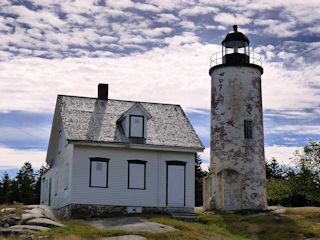
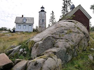
The story surrounding this island and the lighthouse was related to us by a park ranger (actually related to the Gilley family that once lived here) while on a tour of Baker Island. William and Hannah Gilley settled on the island in 1812 to be closer to William’s fishing grounds. The original lighthouse was built near the shore in 1828 and Gilley became the first keeper. He tended the light for 20 years until political disagreements (he refused to become a Whig) led to his removal from the position. His sons reacted by torturing the new lightkeepers in a matter that went to court and resulted in an area of nineteen acres surrounding the lighthouse being awarded to the government, while the Gilleys kept the rest of the island. By the 1985s the original rubblestone structure was considered nearly useless and was in such poor condition that in 1855 it was rebuilt on the highest point of the island and equipped with a modern lens. This is the lighthouse that was observed by the Coast Survey in 1861, and the one that still stands today.
The Coast Guard attempted to discontinue the light twice during the 1990s but the proposal was resisted by fishermen, who still found the light useful. The National Park Service has recently taken over the lighthouse and may eventually turn it into a museum of some kind; the Coast Guard still maintains the light.

