CADILLAC GROUND
Spatial/elevation data
| Coordinates | N 44.3525° W 68.224133° |
| Elevation | 1509 ft. |
| Location | Maine
Hancock County Seal Harbor Quad |
Mark description
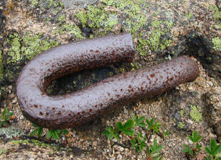
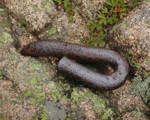
| Type | Iron Bolt |
| Setting | Bedrock |
| Monumented | 1968 by NGS |
| Description (NGS) | NGS Datasheet |
NGS recovery information
Descriptive text
Recovered in good condition.Narrative and photographs
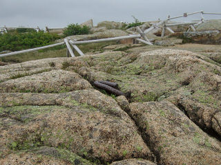
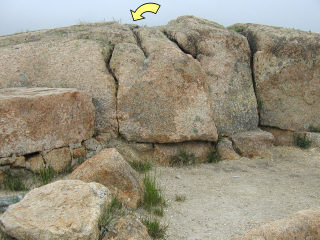
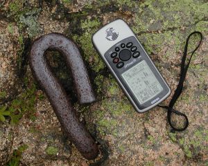
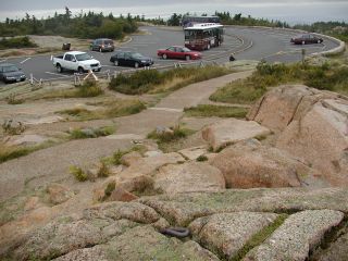
This was my third benchmark find on a day that went very quickly from 90° and sunny (while we were hiking on Bar Island) to about 45°, dark and misty (while we were eating our lobster lunch at Beal’s). Still beneath a heavy fog, we drove to the top of Cadillac Mountain intending to log a few benchmarks and a virtual cache. This unusually-shaped mark was easy to find, especially with Rich along as a guide. It appears to be in good condition.
Update (February 2017): Geodesist Harold Nelson of MaineDOT discovered the following about CADILLAC GROUND:
Carroll F. Merriam, who was with the Pennsylvania Water & Power, lived in, I think Prospect or Corea, ME. He collaborated with the Coast Survey, and created a station called CADILLAC GROUND, as MOUNT DESERT was obscured by trees. He used his heavy transit and taped a baseline.
Merriam also, according to Nelson, promoted surveyors’ education and worked on graphic analytical coordinate computation systems developed by the Maryland Control Survey Division. He surveyed the location of Detatchment ALFA of NAVSAT in Corea, Maine. Bringing it closer to home for me, Merriam also conducted some extensive studies of the Susquehanna River.
Nelson and his wife attempted to find markings of Merriam’s baseline on Cadillac Mountain, but so far haven’t been successful.
(Recovered on September 11, 2002)
N 44° 21.153’ W 068° 13.446’
While vacationing on M.D.I. I decided to search for a few local benchmarks. I drove out along the Park Loop Road from Bar Harbor up to the summit of Cadillac Mountain and easily found the mark using the historical description. At the station my Garmin GPSmap76 receiver indicated approximately 20 feet from the posted coordinates. The bolt is quite visible and is in fair condition. It’s quite an unusual benchmark! ~Rich in NEPA~
