TIDAL 7 STA 31
Spatial/elevation data
| Coordinates | N 44.425018° W 68.999086° |
| Elevation | 12.29 ft. |
| Location | Maine
Waldo County Belfast Quad |
Mark description
| Type | Bench Mark Disk |
| Setting | Rock Outcrop |
| Monumented | 1947 by NGS |
| Description (NGS) | NGS Datasheet |
NGS recovery information
Descriptive text
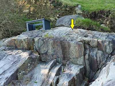
Recovered in good condition atop a large rock outcropping. Mark is about 400 ft SE of the S corner of the Belfast Boathouse (formerly the site of the Wyman Lumber Company), and about 290 ft SE of the SE corner of a timber retaining wall at the boathouse. Mark can be accessed from the beach at low tide. It is also accessible from the private property to the south. Note - the former U.S. Highway 1 bridge over the Passagassawakeag River is now a pedestrian bridge. In 1963 a new highway bridge was built several hundred feet to the north of the former highway bridge.Narrative and photographs
We had some time to kill this morning, and Belfast seemed like the perfect place to explore. We were initially drawn to the area by the pedestrian bridge surrounding the river, which we spotted from Young’s Lobster Pound across the way. But first, we thought we would search for a tidal benchmark station that I spotted on the NGS map.
Often these tidal markers along the shore require crossing private property to gain access, but this one appeared to be on the property of, or at least adjacent to, a town boathouse. That looked promising! So we drove over to Belfast from the lobster pound, just a 5 minute drive at most, and navigated through the twisty and very busy streets of this old town toward the boathouse. The area along the shore here was indeed some combination of a town landing, boathouse, and small beach/park. We made our way over the coarse pebbly sand toward the “notable ledges” that supposedly held the series of tidal marks (two disks and one drill hole).
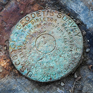
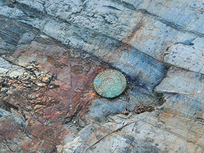
This marker, TIDAL 7, was set on the “third notable ledge,” according to the description. While we zeroed in on the ledge pretty easily, this mark was a bit tricky to spot. The ledge was high and wet, and surrounded at its base by very slippery wet seaweed. I carefully climbed up on the ledge and looked around for a full minute before spotting the disk, which was well camouflaged due to its discolored and eroded state, right in front of me. The stamping can still be read, and the mark is solid in a very stable setting, so I’m calling its condition Good.


