TIDAL 2 STA 31
Spatial/elevation data
| Coordinates | N 44.425041° W 68.999286° |
| Elevation | 10.61 ft. |
| Location | Maine
Waldo County Belfast Quad |
Mark description
| Type | Bench Mark Disk |
| Setting | Rock Outcrop |
| Monumented | 1911 by NGS |
| Description (NGS) | NGS Datasheet |
NGS recovery information
Descriptive text
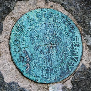
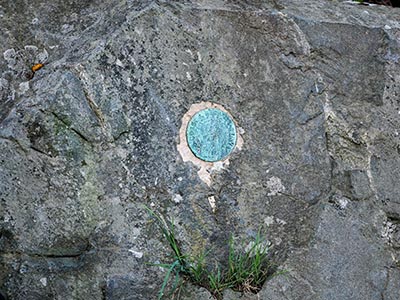
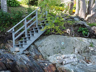
Recovered in good condition set vertically on the northeast face of a prominent rock outcrop. Mark has surface scratches but the designation is still legible and the mark is solid in its setting. Mark is about 350 ft SE of the S corner of the Belfast Boathouse (formerly the site of the Wyman Lumber Company), and about 240 ft SE of the SE corner of a timber retaining wall at the boathouse. Mark can be accessed from the beach at low tide. It is also accessible from the private property to the south. Note - the former U.S. Highway 1 bridge over the Passagassawakeag River is now a pedestrian bridge. In 1963 a new highway bridge was built several hundred feet to the north of the former highway bridge.Narrative and photographs
We had some time to kill this morning, and Belfast seemed like the perfect place to explore. We were initially drawn to the area by the pedestrian bridge surrounding the river, which we spotted from Young’s Lobster Pound across the way. But first, we thought we would search for a series of tidal benchmarks that I spotted on the NGS map.
The first marker on our list was TIDAL 2, and we noticed it immediately because it is bright blue and set vertically in a high ledge, facing right out toward the beach. I moved on to recover another mark in this series, TIDAL 7 set in the adjacent ledge, before documenting this mark. TIDAL 2 is quite worn and the stamping is hard to read, but still legible. “NO. 2” stands out easily. It is in good to fair condition and it is in a very solid, stable setting.


