V 18
Spatial/elevation data
| Coordinates | N 44.456904° W 68.92769° |
| Elevation | 39.31 ft. |
| Location | Maine
Waldo County Searsport Quad |
Mark description
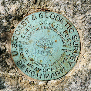
| Type | Bench Mark Disk |
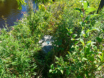
| Setting | Granite Post |
| Monumented | 1933 by NGS |
| Description (NGS) | NGS Datasheet |
Narrative and photographs
We expected to be driving through Searsport again this year, and there was one particular mark I wanted to look for: V 18. Not because it was particularly interesting but because it looked easy, and I figured after a long drive and not much sleep, an easy find would be perfect! I could even see the monument on Google Maps.
When we arrived at the site, things looked a little different from what I expected. The late summer vegetation was high, and the monument was completely buried in weeds and wildflowers! I was concerned about ticks hiding in the dense chest-high vegetation, so I decided against walking right up to the mark. I spotted the monument from the other side of the guard rail and leaned over to try to take a photo of the disk. Fortunately the designation is easily readable, and the disk and monument (from what I could tell) are in good condition.


