F 145
Spatial/elevation data
| Coordinates | N 44.250694° W 68.367861° |
| Elevation | 65.49 ft. |
| Location | Maine
Hancock County Southwest Harbor Quad |
Mark description
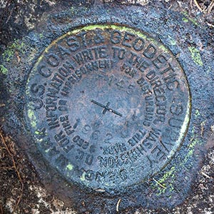
| Type | Bench Mark Disk |
| Setting | Rock Outcrop |
| Monumented | 1962 by NGS |
| Description (NGS) | NGS Datasheet |
NGS recovery information
Descriptive text
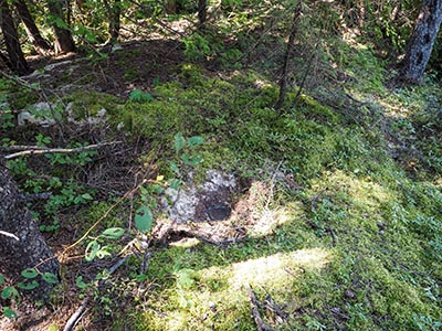
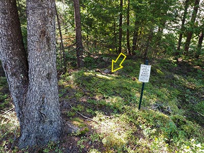
Recovered as described in 2018 note. Outcrop was overgrown and required clearing. Witness post is still in place.Narrative and photographs
F 145 is another mark we can’t believe we didn’t search for in the past. We may have driven by here once and not even attempted a search because of how thickly the area is overgrown, but we’re not sure.
Today, with some coordinates from surveyor “JRO” in hand, and the promise of a witness sign at the site, we decided to give it another try. I spotted the witness sign immediately from the highway, and figured it would be a quick search. The mark was only 6 feet west of the sign, and there are only so many places it could be.
However, it actually took a few minutes of stepping off the distance and then clearing the accumulated vegetation to uncover the mark! It’s hard to believe that in less than 6 years since JRO did his work here, a thick layer of dusty soil, roots, and moss had grown over the mark, completely obscuring it. If the datasheet hadn’t listed the distance from the witness post, and if a tiny peak of bare rock sticking out from the vegetation hadn’t given me some idea of where to dig, I may not have been successful in finding the mark.
The mark is in good condition in a very solid setting. My only concern for it is the fast rate at which it becomes overgrown. However, the witness post and associated directions should alleviate this issue, particularly for anyone who needs to use it professionally.


