TIDAL 2 STA 12
Spatial/elevation data
| Coordinates | N 44.275507° W 68.312012° |
| Elevation | 12.10 ft. |
| Location | Maine
Hancock County Southwest Harbor Quad |
Mark description
| Type | Drill Hole with Lead |
| Setting | Rock Outcrop |
| Monumented | 1879 by NGS |
| Description (NGS) | NGS Datasheet |
NGS recovery information
Descriptive text
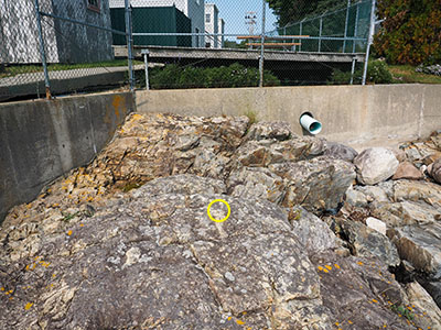
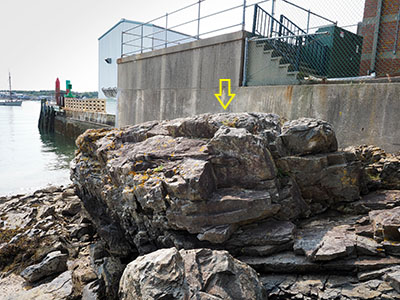
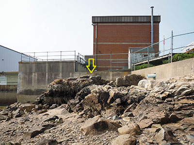
Recovered in good condition. To reach from the US Coast Guard base (Southwest Harbor Sector Field Office) at the south end of Clark Point Road, take the driveway marked 8 Crows Nest on the east side of the fence about 200 ft (61.0 m) southerly along the east side of the Coast Guard buildings to the house at the south end. Obtain permission to enter the property and beach south of the house, and proceed south and east around the house to the end of the fence and concrete retaining wall. Descend to the beach. The mark is set in the top of a prominent outcropping ledge, about 15 feet southeast of TIDAL 6 STA 12 (PE0299). The mark is difficult to spot as it mimics the color, texture, and shape of lichen covering the rock outcrop.Narrative and photographs
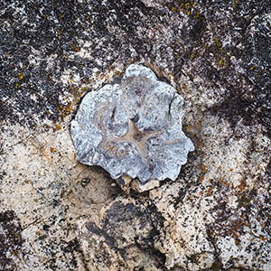
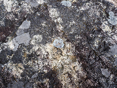
This was such an interesting mark! It was fun to find something obviously old (and to actually know what it was) and to find one that surveyor JRO—who has done so much excellent recovery work in the area—didn’t find. I will admit, it took me a few minutes. Given the description, it wasn’t clear what I was searching for or what it would look like. But the only likely location was the large ledge southeast of TIDAL 6, where JRO suspected that TIDAL 2 would be set. He was correct about that. There is so much gray and white lichen on this outcrop that the white-oxidized lead slug blends in and hides quite easily. It took me two passes over the outcrop to notice it, and even then, I wasn’t sure until I got down close to the mark and noticed the “X” cut in the center and the punch mark that I was sure I’d found a survey mark.
The mark is set on the top of the prominent rock outcrop, approximately 15 feet southeast of TIDAL 6. It is, as described, lead poured into a drill hole, with a punch mark and an “X” cut into the middle of it.
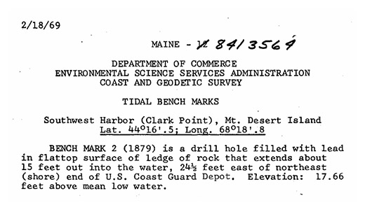
Update (27 December 2024): I figured if anyone would have more information about the history of this mark, it would be Harry Nelson. As usual, he didn’t disappoint! He sent me a different datasheet for this tidal station that includes the monumentation date of TIDAL 2, which is 1879! The complete description is:
BENCH MARK 2 (1879) is a drill hole filled with lead in flattop surface of ledge of rock that extends about 15 feet out into the water, 24½ feet east of northeast (shore) end of U.S. Coast Guard Depot. Elevation: 17.66 feet above mean low water.
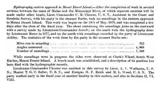
Harry also suggested that I look for the Coast and Geodetic Survey Annual Reports for the years around 1879, which I found easily at NOAA Library’s Coast and Geodetic Survey Heritage Collections: Annual Reports. The full 1879 report is fascinating, and it does indeed mention the tidal station, although it does not directly include a description:
While soundings were in progress the tides were observed at Clark’s Wharf, South West Harbor, Mount Desert Island. A bench-mark was established, and a description of its position has been filed with the hydrographic records.
Update (22 March 2025): While looking for something else on the USGS datasheets, I happened to notice that this station, as well as TIDAL 5 (), are described there as well. Also of interest is a TIDAL 4, which doesn’t currently appear in the NGS database but may still be findable.
Southwest Harbor, in flat top surface of ledge of rock about 50 ft. E. from shore end of Eastern Steamship Co. Wharf, 85 ft. from SW. cor. of building, formerly Clark’s Store, 90 ft. from SE. cor. of old foundation, formerly part of Clark’s store; lead plug USC&GS BM No. 2 (1979) And TIDAL 4: Southwest Harbor, cross cut in flat top surface of rock about 24 ft. E. of shore end of Eastern Steamship Co. wharf, 70 ft. from SW. cor. of building formerly Clark’s store, 110 ft. from SE. cor. of old foundation, formerly part of Clark’s store “U.S.C. & G.S. B.M. No.4 (1905)”
