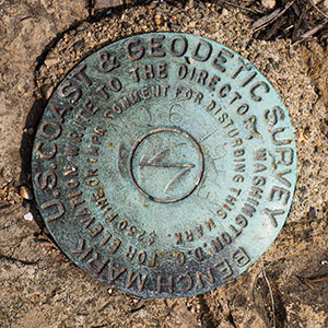
TIDAL 6 STA 12
Spatial/elevation data
| Coordinates | N 44.275533° W 68.312049° |
| Elevation | 12.50 ft. |
| Location | Maine
Hancock County Southwest Harbor Quad |
Mark description
| Type | Bench Mark Disk |
| Setting | Rock Outcrop |
| Monumented | 1953 by NGS |
| Description (NGS) | NGS Datasheet |
NGS recovery information
Descriptive text
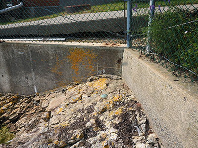
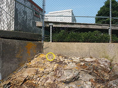
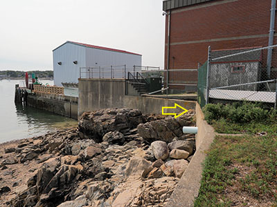
Recovered in good condition. The beach was accessed via the property at 8 Crows Nest as described in the 2018 recovery note. The 2018 description is adequate to recover the mark.Narrative and photographs
We’ve known about this series of tidal marks for a long time, probably since I began visiting this area annually in 2005. But for some reason we always thought they would have to be accessed through the Coast Guard property, which seemed unlikely to happen.
A few weeks ago, though, we noticed that our reliable professional surveyor JRO, who has left very hepful recovery notes for many marks on the island, had found this mark in 2018. He described accessing the beach area via the house neighboring the Coast Guard facility, so that is what we planned to do today.
We walked down the driveway labeled 8 Crows Nest, and knocked on the door of the small house overlooking the beach. A man came to the door immediately. We told him what we were looking for and asked if we could access the shore. He said he was only a renter, but that he had no problem with it. Great!
Rich and I climbed down on the rocks and carefully made our way over to the corner of the retaining wall. We could spot the blue-green disk from a distance. I climbed over to it and then searched for (and eventually found) nearby TIDAL 2 before documenting this disk. This one is in very good condition in a stable setting, and is the easiest mark of this series to locate.


