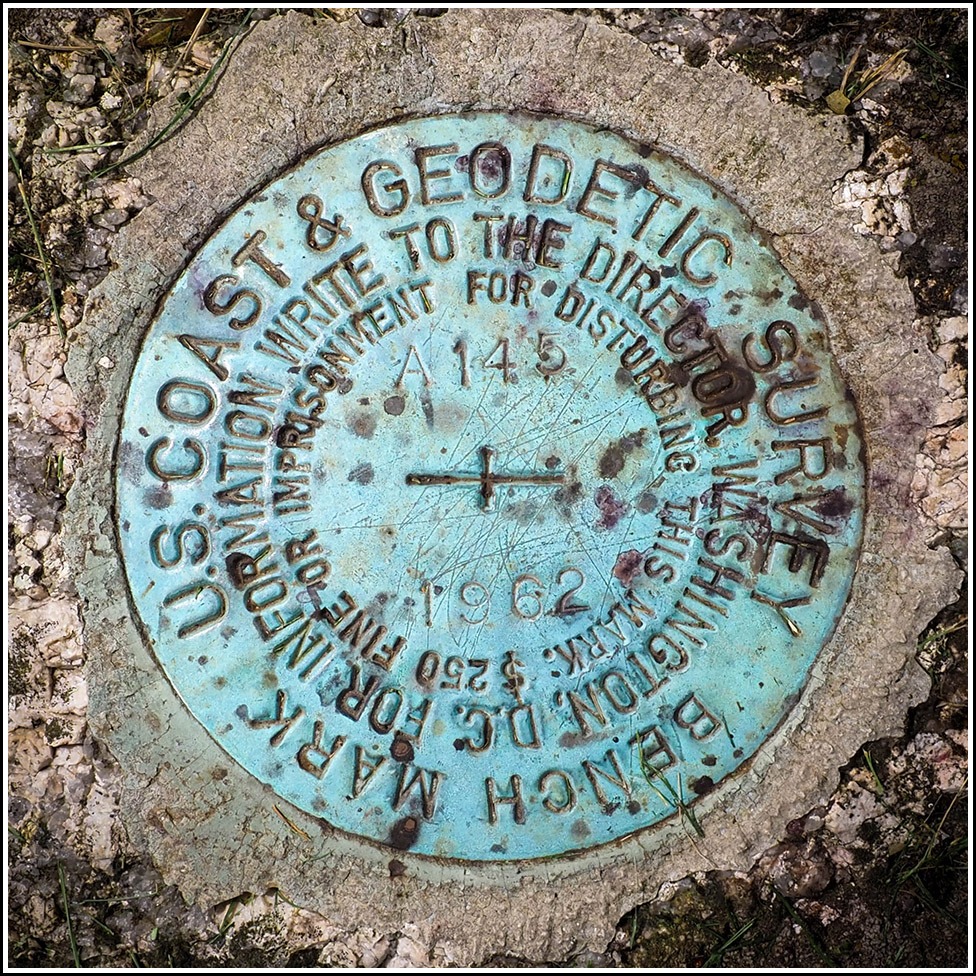
A 145
Recovered in Good Condition on September 10, 2024
Spatial/elevation data
| Coordinates | N 44.290013° W 68.329601° |
| Elevation | 16.72 ft. |
| Location | Maine
Hancock County Southwest Harbor Quad |
Mark description
| Type | Bench Mark Disk |
| Setting | Boulder |
| Monumented | 1962 by NGS |
| Description (NGS) | NGS Datasheet |
NGS recovery information
Descriptive text
Recovered in good condition. The 2023 description and photographs are adequate.Narrative and photographs
Our third find along today’s Route 102 benchmark run was A 145, and it was the easiest find of the day. We pulled off the road right before the mailbox for #180, and I could see the boulder (and the disk on top of it) all the way from the road. I was a little concerned because it was so close to the house, but there were no vehicles in the driveway and the house was dark, although I spotted a few open windows. I was able to photograph the mark without incident. It is in very good condition and is likely in a stable setting for years to come.


 toward the mark")