OAK TREE LODGE
Spatial/elevation data
| Coordinates | N 41.584386° W 75.431516° |
| Elevation | Unknown |
| Location | Pennsylvania
Wayne County Waymart Quad |
Mark description
| Type | Survey Mark |
| Setting | Concrete Slab |
| Monumented | 1977 by PennDOT |
| Description (PennDOT) | See: OAK TREE LODGE |
Narrative and photographs
I wouldn’t expect that a PennDOT datasheet would be a cause for an outburst of laughter, but that’s exactly what happened in this case. OAK TREE LODGE was a nudist colony in 1977?! That’s hilarious and so … 1977. What made it even funnier was that it was most recently a religious retreat center! We just had to check it out.
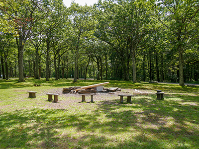
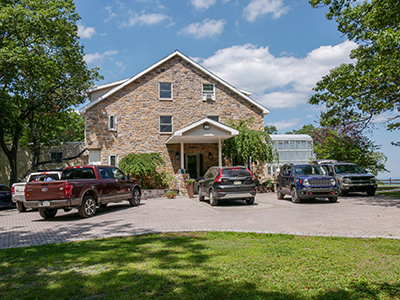
We drove up to the site to find a fancy, relatively new (or newly renovated) building and a frenzy of construction activity underway. We parked and began to walk toward the coordinates. A man approached us. He introduced himself as the groundskeeper, Mark. We expected that he might have come across the benchmark at some point, but he had no knowledge of it. He said we were welcome to walk and look around, though, and gave us a few tips about where we might find a concrete slab. At the coordinates, we found nothing but grass. Nearby is a fire pit, which Rich surmises may have been built atop the slab, but there’s really no way to find out other than to dig through inches of soot, which we weren’t about to do.
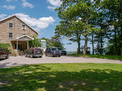
A few women were sitting in a small pavilion to the right of the building, right on the edge of the ridge with a wide view over the valley. One of the women appeared to be in charge and we told her what we were looking for. Before we even mentioned anything about it, she said “You know this place used to be a nudist colony, right?” Of course I said, yes, we saw it on the datasheet, and had to run right up here! She then explained that they were turning the retreat center into a treatment facility (still called God’s Mountain) for women. She was extremely enthusiastic and walked around with us while we searched. She didn’t know anything about survey mark hunting but was familiar with geocaching.
Rich and I continued to look around the property but didn’t see anything that looked promising. The location of the coordinates doesn’t quite line up with where the mark is indicated on the diagram, so we were sure to widen our search considerably. It even occurred to me that the little pavilion might have been built on top of the concrete slab (it is east of the building, or at least east of the existing building; we don’t know how the original structure was altered). And it would be a good place for a flagpole, which is long since gone. Needless to say there was no way to get a look underneath the pavilion, so we weren’t able to test that hypothesis. Old aerial images don’t offer a high enough resolution to determine much about how the site looked historically, and I wasn’t able to find any other information about the area in the 1970s. So this one will remain a very interesting mystery, for now!


