NPS (Unstamped, Acadia #7)
Spatial/elevation data
| Coordinates | N 44.245083° W 68.202° |
| Elevation | Unknown |
| Location | Maine
Hancock County Baker Island Quad |
Mark description
| Type | Unspecified Disk |
| Setting | Rock Outcrop |
| Monumented | Unknown by National Park Service |
| Description (National Park Service) | Unavailable. |
Narrative and photographs
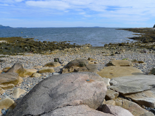
The Baker Island tour is one of the Acadia National Park ranger programs. I’ve wanted to take this tour for years, but it never worked out until this year. We left from Bar Harbor on one of the Bar Harbor Whale Watch Company’s “lobster passenger” boats (as the company calls it)—the Miss Samantha—and, after a pleasant ride of about 40 minutes, approached Baker Island. We then boarded a skiff for the last part of the journey, to take us through shallower water and up onto the rocky beach of the island.
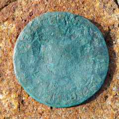
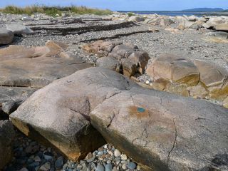
We were part of boatload #1, so we had some time to explore the island while the skiff went back to the Miss Samantha to shuttle in the rest of the group. I didn’t expect to find any survey marks here other than the Baker Island lighthouse and the old Coast Guard tower on Islesford across the channel, both of which are landmark stations. But often there are surprises waiting for us. We weren’t on the island more than a minute before I spotted this blue-green disk on a large outcrop!
Our assumption was that this was another topographic station, as we’ve seen along the shorelines of several of the small islands near Mount Desert Island. But a closer look at the photographs revealed that the disk is actually an NPS marker similar to other NPS boundary markers that we’ve found. The text around the outside of the disk reads “U.S. DEPARTMENT OF THE INTERIOR” and inside that, “UNLAWFUL TO DISTURB - NPS.” If there was ever any stamping to indicate a designation, it has long since weathered away.


