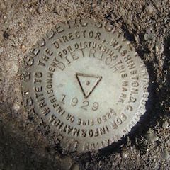
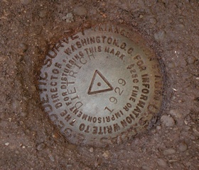
DIETRICH
Spatial/elevation data
| Coordinates | N 41.592633° W 76.00505° |
| Elevation | 1496 ft. |
| Location | Pennsylvania
Wyoming County Meshoppen Quad |
Mark description
| Type | Triangulation Station Disk |
| Setting | Square Concrete Monument |
| Monumented | 1929 by NGS |
| Description (NGS) | NGS Datasheet |
NGS recovery information
Descriptive text
The station mark and reference marks 1 and 2 were recovered in good condition with the assistance of Steve and Ruth Lasco. Reference Mark 1 is approximately 17 feet east of a powerpole numbered NPP A43X1979 and BFC 10. A rock retaining wall has been built upon the bedrock that holds Reference Mark 2, and the reference mark sits in a cutout, approximately 20 inches below the top of the wall.Narrative and photographs
Continuing on up the road after our recovery of LASCO, we came to somebody’s house and, as our luck would have it, the GPSr was indicating that the coordinates for this station were directly in their front yard. Having had plenty of practice asking permission lately, Rich approached the door and was greeted by a friendly elderly woman who was familiar with the marks. If she’d been better able to walk, she said, she’d come out and show us where they were. No need, we explained; we had enough information to find them on our own.
Nevertheless she did appear at our side just as we were examining the station mark, and her husband came from the house a moment later. He was familiar with all three disks, and he guided us to the reference marks while explaining that he and his wife had owned the property since the mid-1960s and that since then, the station has been visited several times. The man watched with interest as we cleaned and photographed the marks, and then he and his wife went back inside as we wrapped up our work.
Rich and I had promised to e-mail our photos of the marks, but we’d forgotten to ask for their e-mail address, so I knocked on the door again. I chatted with the woman and man for a few minutes and I realized we’d never introduced ourselves. I gave our names, and she said “I’m Ruth Lasco, and this is Steve.” This was exciting! All the while I’d had no idea this was the same man mentioned in the 1968 recovery of DIETRICH (and the monumenting of LASCO). He’s 94 years old and still full of energy! Steve related stories about how he’d watched the surveyors recover and place the marks in 1968 and how he’d asked for the new mark to bear his name. Several weeks later, he and Ruth e-mailed me confirming that the LASCO azimuth mark has been either covered over or removed. I was so impressed that they went out of their way to help us. This was a very memorable benchmark hunt and I’ll always treasure the experience!
Recovered in good condition.
This second order triangulation station is situated on the northerly end of the ridgeline of Florey Knob, in the yard of an old farmhouse roughly 4.8 airline miles northwest of Tunkhannock. The 1968 “to reach” directions are still applicable. A handheld GPS receiver made locating the station a relatively easy task, as did some coaching from Mr. and Mrs. Steve Lasco who had excellent recollections of the time when the marks were last recovered.
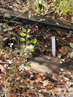
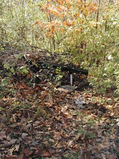
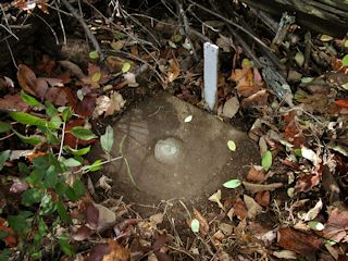
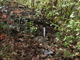
The historical description leads reliably to the station and the two reference marks, which were found as described. A short wooden witness post painted white indicates the station at the brushy west edge of the yard. RM1 is 17 feet east of a powerpole numbered NPP A43X1979 and BFC 10. RM2 is nestled at the bottom of a cubbyhole in a rock retaining wall, between two large piles of bricks at the west edge of the yard, and about 20 inches below the top of the wall.
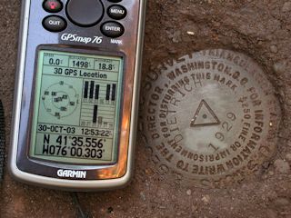
At the station a Garmin GPSmap76 receiver with active remote antenna was used to record WAAS-corrected coordinates which were 12.2 feet from the adjusted coordinates listed on the NGS datasheet. All marks are well exposed, in good condition, and the stamped designations are legible. ~Rich in NEPA~
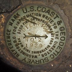
| Designation | Status | Condition | Image |
|---|---|---|---|
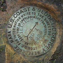
| DIETRICH RM 1 | Recovered | Good |
|
| DIETRICH RM 2 | Recovered | Good |
|
