BIG PINE HILL LOOKOUT TOWER
Spatial/elevation data
| Coordinates | N 41.235427° W 75.635909° |
| Elevation | Unknown |
| Location | Pennsylvania
Lackawanna County Pleasant View Summit Quad |
Mark description
| Type | Landmark/Intersection Station |
| Setting | Fire Lookout Tower |
| Monumented | 1955 by NGS |
| Description (NGS) | NGS Datasheet |
NGS recovery information
Descriptive text
Recovered in destroyed condition.Narrative and photographs
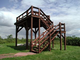
Rich and I discovered that the tower referred to in the description has been removed. The current replacement is a wooden observation platform in approximately the same location.
Station landmark no longer exists.
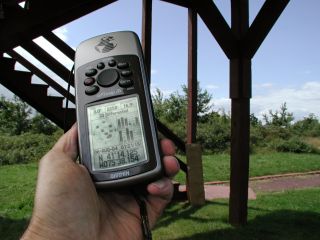
This third order horizontal control station was located and positively identified but the station landmark was destroyed. The steel fire tower was completely dismantled and removed, and a shorter wooden observation platform (which has no value as a geodetic control point) was constructed in its place. At the center of the new platform a Garmin GPSmap76 receiver was used to record WAAS-corrected coordinates which were identical (within 0.001 minute) to the adjusted coordinates listed on the NGS datasheet.
~Rich in NEPA~
Note: Zhanna will take care of submitting an official “destroyed” recovery report to NGS along with photos of the available evidence.

