BEARFORT MTN LOT
Spatial/elevation data
| Coordinates | N 41.10425° W 74.4174° |
| Elevation | Unknown |
| Location | New Jersey
Passaic County Newfoundland Quad |
Mark description
| Type | Landmark/Intersection Station |
| Setting | Fire Lookout Tower |
| Monumented | 1973 by NGS |
| Description (NGS) | NGS Datasheet |
Narrative and photographs
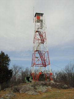
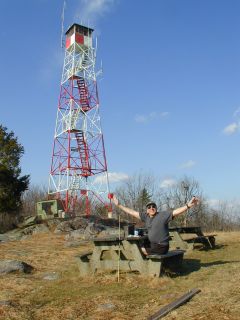
Like Rich, we came upon this tower as part of our hunt for the “Bearfort Fire Tower” cache. The description and coordinates are more than adequate to locate the tower. I bet there’s a great view from the top, but it was too windy and cold today to check it out for myself!
The “Bearfort Fire Tower” Geocache is the namesake of this well-known landmark. During my hunt for the cache I took advantage of the opportunity to record this station along with another nearby set of survey marks. The historic description leads to the correct location, and there is no disc or marker other than the lookout tower itself. At the approximate center of the tower’s base my Garmin GPSmap76 receiver indicated 11 feet from the NGS datasheet coordinates. ~Rich in NEPA~

