4 B
Spatial/elevation data
| Coordinates | N 41.048183° W 75.972033° |
| Elevation | 1150.15 ft. |
| Location | Pennsylvania
Luzerne County Freeland Quad |
Mark description
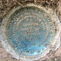
| Type | Bench Mark Disk |
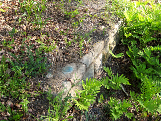
| Setting | Stone Culvert |
| Monumented | 1942 by USGS |
| Description (NGS) | NGS Datasheet |
NGS recovery information
Descriptive text
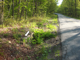
Recovered in good condition in the rock back wall of a culvert on the northwest shoulder of North Old Turnpike Road (S.R. 3021). The telephone pole referred to in the description was not found.Narrative and photographs
With some time to kill before meeting Ken and Gina at their house in Sand Springs, I decided to check out a few nearby benchmarks. I had thought EDGEWOOD (LY1550) would be an easy tri-station, but as I drove by the spot I could see that it’s down in a brushy heavily wooded ravine. No-go today. Maybe in the winter.
4 B was supposed to be just a short distance down the road. As it’s another mark in the USGS “B” series in this area, I was really hoping to find it. And this one was an easy find! I spotted it on top of a rock culvert as I drove by. There is a convenient spot to pull off the road just southwest of the mark. The recovery was easy since the culvert was mostly clear of debris and very close to the road. The disk is in good condition and the culvert headwall seems reasonably stable. Its position close to the road may put it in some danger of being struck by a snowplow.
I looked for the reference mark on the culvert headwall across the road, but the corners were damaged and no chiseled square was evident.


