U 235
Spatial/elevation data
| Coordinates | N 41.320716° W 75.152566° (estimate) |
| Elevation | 1851.18 ft. |
| Location | Pennsylvania
Pike County Promised Land Quad |
Mark description
| Type | Bench Mark Disk |
| Setting | Rock Outcrop |
| Monumented | 1959 by NGS |
| Description (NGS) | NGS Datasheet |
NGS recovery information
Descriptive text
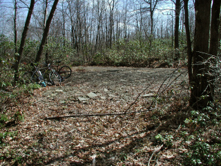
Mark not found. The station was searched for on two separate occasions. Following Lake Laura Road southwesterly for 1.8 miles from PA Route 402 leads to an intersection with a trail west. Coordinates for the trail intersection are 41 19 14.6(N) 075 09 9.2(W). Property is owned by the Blooming Grove Hunting and Fishing Club. Contact Information - Scott F. Savini, General Manager, HC 8 BOX 8066, Hawley, PA 18428, 570-775-7371.Narrative and photographs
I was excited about this mark because it would provide the link between part of the 237 line stretching through Promised Land State Park to the boundary of Blooming Grove Hunting and Fishing Club property, and the 235 line (running along Route 402 and Lake Laura Rd.) We first searched for this mark on December 29, 2003, when we had to contend with a light dusting of snow on the ground. We could not find any evidence of the mark or the rock in which it was supposedly set, but we assumed our failure was due to the snow and we resolved to return in the Spring.
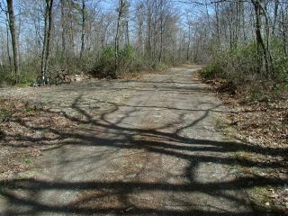
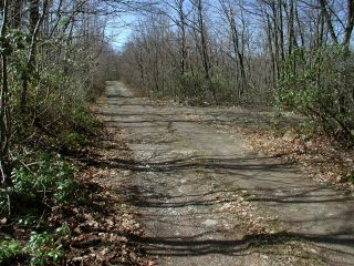
April 17 was the day of our return, and this time we rode in on our bikes, which gave us the advantage of being able to measure 1.8 miles along Lake Laura Road from its intersection with the highway. We did so and ended up at the very intersection we’d searched in December. Even without snow on the ground, the task was a difficult one and though we probed the ground and scraped off rocks for well over an hour, we could not find the mark. It is evident that the road has been graded and possibly widened since the mark was placed. The mark may have been destroyed at that time, or may still exist but simply be covered by excavated material.
Mark not found.
Extensive searches for this station were performed on two separate occasions. The suspected site was approached from Rt. 402 by traveling west along Lake Laura Road (a gravel track road that is private and gated) for roughly 1.8 miles to where a trail branches off westerly. The coordinates listed for this log are for the center of the intersection. At this point Lake Laura Road runs north-northeast/south-southwest and its surface appears to have undergone varying degrees of maintenance and improvement over the years, with sections having been filled, graded and possibly widened. The historic description provides very little to go on. It’s likely that the mark still exists and was covered over by rocky fill. The property is owned by the Blooming Grove Hunting & Fishing Club.
~Rich in NEPA~


