491
Spatial/elevation data
| Coordinates | N 41.406667° W 74.742216° (estimate) |
| Elevation | 490.91 ft. |
| Location | Pennsylvania
Pike County Port Jervis North Quad |
Mark description
| Type | Survey Disk |
| Setting | Bridge Abutment |
| Monumented | 1900 by USGS |
| Description (NGS) | NGS Datasheet |
Narrative and photographs
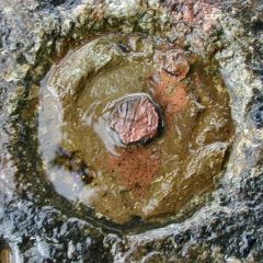
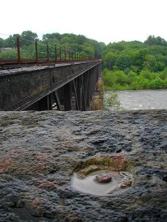
I simply couldn’t be this close to a benchmark (one with a degree of risk, no less) and not try for it. So after locating LY0621, I ran across the railroad bridge to search for this mark on the other side. It was a lot of fun, if you don’t look down (this bridge was much higher over the river than I expected) and if you ignore the way the metal plates under your feet feel and sound loose. Just trust the bridge. There were plenty of people rafting on the river and fishing on the shore, but I didn’t think any of them would turn me in for trespassing; I only wonder if these tracks are still used. Fortunately I had no run-ins with the law or with locomotives. Unfortunately, once at the northwest abutment I could see that the disk has been broken off from the stem, which survives (and has likely been used as a survey point; notice the orange paint). While near the mark, the rain, thunder and lightning began again, and so I made a quick dash back across to the New York side.


