L 362 RESET
Spatial/elevation data
| Coordinates | N 40.923433° W 75.09655° |
| Elevation | Unknown |
| Location | Pennsylvania
Northampton County Portland Quad |
Mark description
| Type | Vertical Control Mark |
| Setting | Bridge Abutment |
| Monumented | 2002 by NGS |
| Description (NGS) | Official description unavailable; this mark replaces KV2878 but no datasheet exists in the database. |
Narrative and photographs
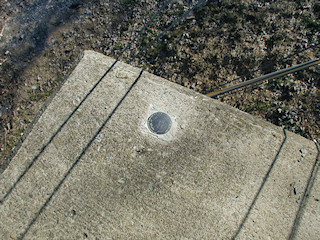
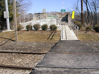
I had no reason to expect KV2878 to be anything other than a straightforward find. I was surprised, therefore, by the strange situation I came across at the bridge. A concrete handicapped access ramp has been built atop the flat recessed area that once held the benchmark disk. While it may still exist, it is not currently accessible.
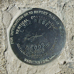
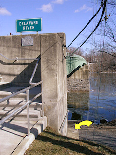
I did, however, spot a mark several meters down below set into the bridge abutment. Further inspection showed this to be stamped L 362 RESET 2002, which I assume is the reset referred to by PennDOT in their 2003 recovery. However, no datasheet exists for this reset mark. Without current data, the mark cannot be used nor can updates be submitted to NGS. Also strange is that it appears (from the logs of geocachers and PennDOT’s recovery note) both the reset mark and the original mark were in place concurrently, for at least several months.
The reset disk is in good condition with legible stamping. WAAS-corrected coordinates provided are for the reset mark.
Information about the current status of KV2878 and the reset mark has been submitted to NGS. They have confirmed that there is no datasheet in their database for the reset mark, and therefore no official recovery can be submitted. NGS is working to correct this situation.


