READING
Spatial/elevation data
| Coordinates | N 40.335334° W 75.916062° |
| Elevation | 332.96 ft. |
| Location | Pennsylvania
Berks County Reading Quad |
Mark description
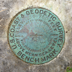
| Type | Bench Mark Disk |
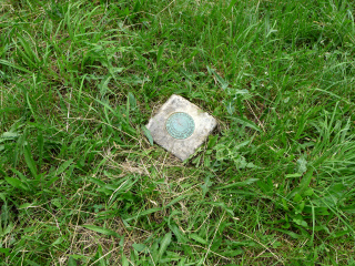
| Setting | Marble Post |
| Monumented | 1932 by NGS |
| Description (NGS) | NGS Datasheet |
Narrative and photographs
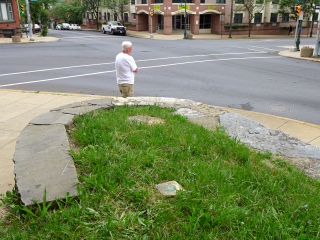
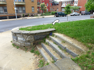
I don’t make a habit of including political commentary in my survey mark recoveries, so I’ll just say that it’s a despicable shame what has happened to the formerly beautiful town of Reading over the past decade. Case in point: this mark is set at one entrance to a park at the base of Mount Penn, directly below the famous pagoda that sits at Mount Penn’s peak. Old stonework stands as one of the few reminders that people once cared about their town. Today the entire area was covered with trash, junk was blowing by down the street like tumbleweeds, and car by car passed by blasting truly filthy music. (And I’m no prude.) Shame.
Dad and I found the tri-station set into the monument nearly flush with the surface and partially overgrown. The disk is in fair condition (the designation is faint and hard to read) but the setting seems solid. It began to rain as I was photographing the mark so we decided to leave the reference marks for another time. I didn’t realize that one of the RMs was the Water Bureau mark we had just found, and that the other was set in the sidewalk across the street. Next time.
| Designation | Status | Condition | Image |
|---|---|---|---|
| READING RM 1 | Note Entered | Unknown (Not Found) |

|


