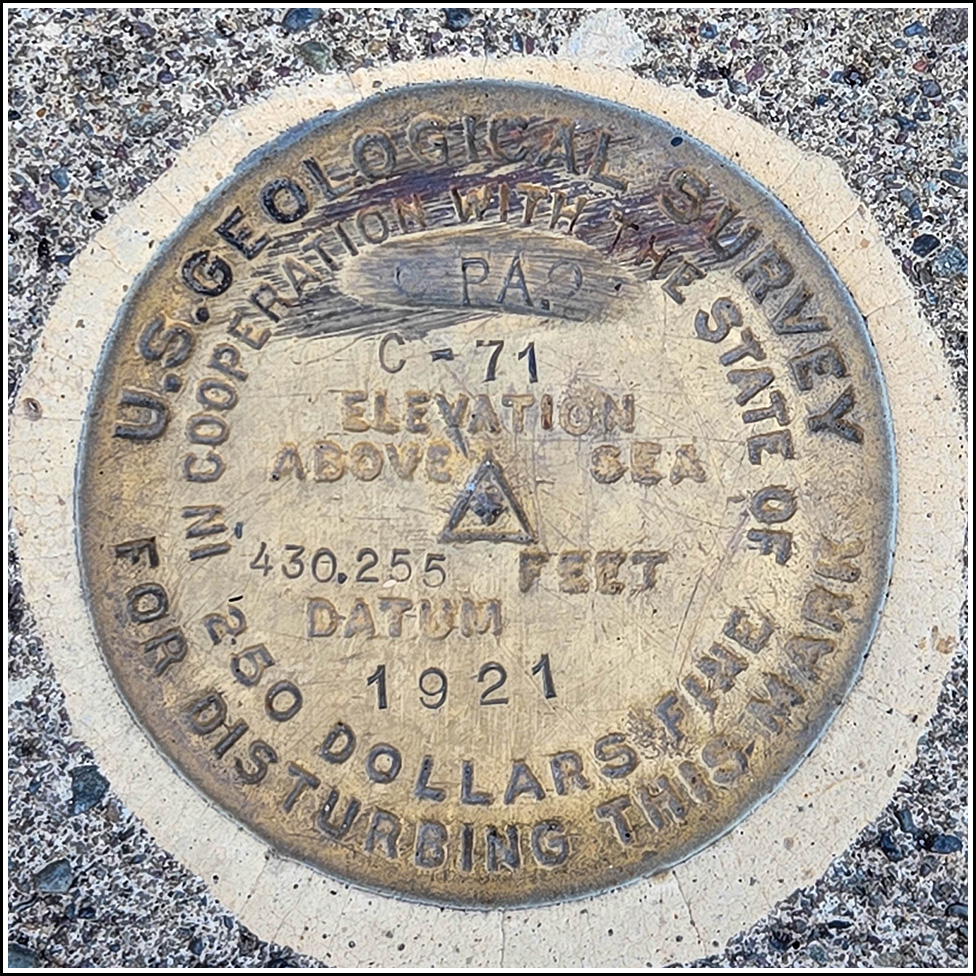
C 71
Spatial/elevation data
| Coordinates | N 40.9864444° W 75.1947309° |
| Elevation | 429.67 ft. |
| Location | Pennsylvania
Monroe County Stroudsburg Quad |
Mark description
| Type | Survey Disk |
| Setting | Mat Foundation/Cannon Base |
| Monumented | 1921 by USGS |
| Description (NGS) | NGS Datasheet |
Narrative and photographs
After a 10km hike at nearby Mt. Tammany in the Delaware Water Gap, Ken, Gina, Alan, and I stopped in Stroudsburg for our traditional post-hike pizza party. The pizzeria we chose, Benvenuto’s, turned out to be a good pick. The New York-style pizza was excellent. Along with some water, iced tea, or soda depending on who you were, it really hit the spot after a strenuous walk in the woods.
Of course, nothing truly completes a fun, exciting day outdoors quite like a benchmark hunt! This wasn’t much of a “hunt” because the location of the mark is so obvious it can even been seen clearly on Google Street View, but it was still a lot of fun to find the mark. As a bonus, this is a particularly neat mark because it’s gold in color like a few others we’ve found over the years, and because it’s set into the base of a cannon. This little park where the cannon (and hence the benchmark) is located was only about a quarter-mile from the pizza place, so I offered to just run over there and recover the mark by myself, but Ken and Gina offered to drive us over. I documented the mark, and Ken and Gina found a suitable parking spot in front of Cafe Duet. The cafe had just closed for the day, but Ken and Gina are big fans of coffee shops, so they’ll be back!
The mark is in excellent condition (surprising for such an exposed mark, and for one that is over 100 years old). This little park is Stroudsburg’s courthouse square, and features several monuments in addition to the cannons.


