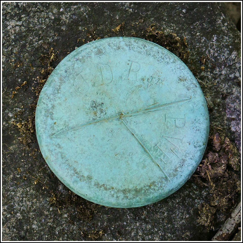
JDR/PVT
Recovered in Good Condition on September 9, 2019
Spatial/elevation data
| Coordinates | N 44.389694° W 68.226305° |
| Elevation | Unknown |
| Location | Maine
Hancock County Bar Harbor Quad |
Mark description
| Type | Boundary Monument |
| Setting | Granite Post |
| Monumented | Unknown by Unknown Agency |
Narrative and photographs
This is one of several boundary markers we found in deep woods while exploring near the old Archbold estate. This one appears to be in good condition, with the post set deeply in the ground. Like JDR, this monument is also surrounded by a number of pink flags that indicate it may still be in use and/or indicate a modern boundary between park and private land.

