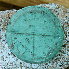
JDR/JDR/PVT
Spatial/elevation data
| Coordinates | N 44.3778° W 68.222° |
| Elevation | Unknown |
| Location | Maine
Hancock County Bar Harbor Quad |
Mark description
| Type | Boundary Monument |
| Setting | Granite Post |
| Monumented | Unknown by Unknown Agency |
Narrative and photographs
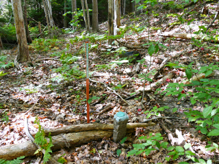
After Dad left this morning for his return trip home, Rich and I decided to check out a relatively “new” trail: the Kebo Brook Trail, an old trail that was rehabilitated and put back on the maps in 2012. Our main goal was to check out the trail and take some photographs while the morning was still foggy (although that didn’t last long). I had no idea we would spot a boundary marker with disk while we were walking along the trail! It was several yards into the woods close to the Kebo Valley golf course, but quite easy to spot and to access from the trail. The boundary disk is divided into three parts, two of which are stamped JDR and one which is stamped PVT. The disk is in good condition and is adjacent to a standard orange NPS boundary post.

