OC 9
Spatial/elevation data
| Coordinates | N 38.435116° W 75.0547° |
| Elevation | 9.02 ft. |
| Location | Maryland
Worcester County Assawoman Bay Quad |
Mark description
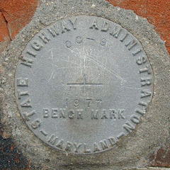
| Type | Bench Mark Disk |
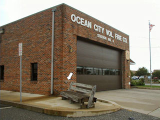
| Setting | Brick Wall |
| Monumented | 1977 by MDDOT |
| Description (NGS) | NGS Datasheet |
Narrative and photographs
This Maryland State Highway Administration survey disk was found easily using the historic description. No changes are necessary. The disk is in good condition with legible stamping.

