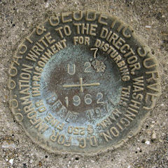
U 27 RESET 1971 DEDHT
Spatial/elevation data
| Coordinates | N 38.513266° W 75.055183° |
| Elevation | 4.0 ft. |
| Location | Delaware
Sussex County Bethany Beach Quad |
Mark description
| Type | Bench Mark Disk |
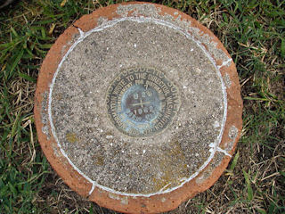
| Setting | Concrete Tile |
| Monumented | 1971 by Delaware Dept. of Highways and Transportation |
| Description (NGS) | NGS Datasheet |
Narrative and photographs
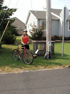
This benchmark disk was found as described in a concrete filled tile in the southwest corner of the intersection of Sussex Place and the southbound lanes of Route 1. The mark was located easily using the historic description, but note that the witness post no longer exists and that Route 14 is now Delaware State Route 1. The mark is approximately three feet east of a utility pole numbered 62454 / 9 465. At the site, I recorded coordinates that are approximately 338 feet from the coordinates given on the datasheet. The disk is in good condition and the date and designation are clearly legible. It appears that this disk initially was incorrectly stamped with U 28 instead of U 27.


