NN 95
Spatial/elevation data
| Coordinates | N 32.24335° W 111.16232° |
| Elevation | 2869 ft. |
| Location | Arizona
Pima County Brown Mountain Quad |
Mark description
| Type | GPS Survey Monument |
| Setting | Rock Outcrop |
| Monumented | 1991 by Pima County DOT |
| Description (NGS) | NGS Datasheet |
NGS recovery information
Descriptive text
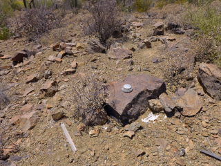
Recovered in good condition.Narrative and photographs
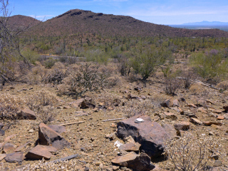
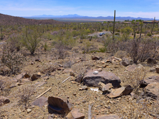
NN 95 is one of a series of relatively new GPS stations near Brown Mountain. This type of mark isn’t a high priority for us, but we chose to recover this one because we were in the area anyway, and it turns out that the view of Brown Mountain from here is fantastic! You can easily see all three peaks, and you get a sense of the terrain traversed by the ridgeline trail. To the west is an expansive view over a cactus-filled valley.
The choice of setting for this mark is curious. While the datasheet calls it a “rock outcrop,” it appears to be a boulder sitting on the surface—not the most stable setting, I would think. But the disk itself is in good condition and is set solidly into the rock. It is easily accessible, requiring just a short climb up the hillside from Kinney Road.
It was a tricky descent on the dry rocky gravel slope and Rich slipped and put his hand right on one of the cute fishhook Mammillarias that are common in this area. We spent a few minutes pulling out the spines from Rich’s hand (and we checked on the cactus, too—aside from the missing spines it, too, seemed to be fine).


