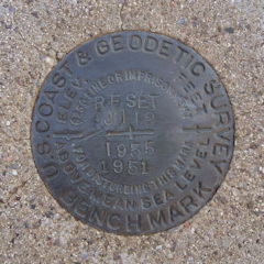
J 112 RESET
Spatial/elevation data
| Coordinates | N 32.302267° W 111.208316° |
| Elevation | 2386.4 ft. |
| Location | Arizona
Pima County Avra Quad |
Mark description
| Type | Bench Mark Disk |
| Setting | Round Concrete Monument |
| Monumented | 1951 by NGS |
| Description (NGS) | NGS Datasheet |
NGS recovery information
Descriptive text
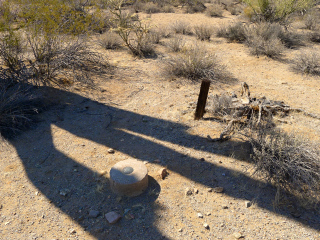
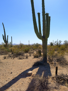
Mark recovered in good condition. Wooden post was found within five feet of the monument and is presumed to be the witness post. Handheld GPS coordinates for the mark are 32 18 08.2(N) 111 12 29.9(W).Narrative and photographs
J 112 RESET was our final find of the day along the Encinas Trail in Saguaro National Park. We didn’t hike the entire trail, but instead hiked in from the southeast corner to find the first two marks, and then drove around and hiked down from the northwest corner to find the remaining two marks along the trail. Like the others, this benchmark was in good condition, set into a round concrete monument near the base of a saguaro cactus. The wooden witness post still stands a few feet away from the monument.


