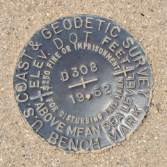
D 308
Spatial/elevation data
| Coordinates | N 31.89202° W 112.81989° |
| Elevation | 1436.24 ft. |
| Location | Arizona
Pima County Lukeville Quad |
Mark description
| Type | Bench Mark Disk |
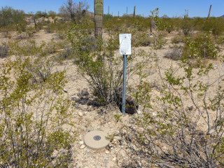
| Setting | Round Concrete Monument |
| Monumented | 1952 by NGS |
| Description (NGS) | NGS Datasheet |
NGS recovery information
Descriptive text
Recovered in good condition. The witness post is still present. (Also reported that the monument projects 2 inches.)Narrative and photographs
D 308 was the first in a series of eight benchmarks we found today along Puerto Blanco Drive. Our goal for the day was to reach Quitobaquito Spring, which Rich has wanted to show me for many years (the last time we were in Organ Pipe N. M., the entire western side of the park was closed). Although I hadn’t prepared for any benchmarks along the road, I knew I had seen quite a few on the topo map—approximately one per mile. Initially my thoughts were that it would be easy enough to spot the monuments from the road. But last night, I decided to attempt to pull coordinates from the map so we would at least have an idea where to look. That worked out well, because it turns out that most of the marks would have been quite difficult to spot if we hadn’t had a good idea where to look. (And in fact, several of the ones we looked for still eluded us.)
This morning, Rich was stung by a scorpion outside our bed & breakfast. A crazy experience, to be sure! And I was perfectly fine with just staying in the room all day and resting, if that’s what he wanted. But he was determined to attempt our car-tour to Quitobaquito, and it worked out really well. I think having some BMs to look for helped distract him from the pain and strange sensations in his legs.
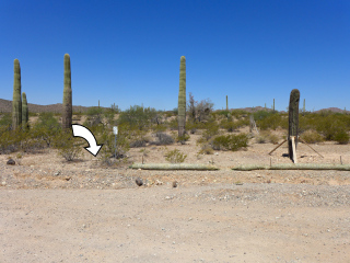
D 308 was probably the easiest mark to find, since it’s right along the side of the road and is marked by an obvious witness post with a sign. The disk and monument are in excellent condition.


