AZHD (Unstamped)
Spatial/elevation data
| Coordinates | N 32.006933° W 109.43895° |
| Elevation | Unknown |
| Location | Arizona
Cochise County Bowie Mtn South Quad |
Mark description
| Type | Unspecified Disk |
| Setting | Round Concrete Monument |
| Monumented | Unknown by AZDOT |
| Description (AZDOT) | Unavailable. |
Narrative and photographs
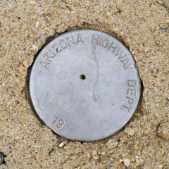
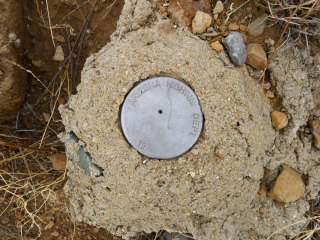
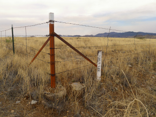
This unstamped Arizona Highway Dept. disk was a bonus find during our recovery of the tri-station PINERY 2 nearby. Both marks are in the northeast corner of the intersection of Arizona Routes 181 and 186. This disk is in good condition, although it is set into a mound of chunky concrete that has seen better days. It is near the corner of a right-of-way fence and about two feet from a white-painted witness post labeled HWY. R. OF W. There is no stamping on the disk, other than the boilerplate agency marking and “19,” to which I assume was to be appended the year of establishment, during the last century.


