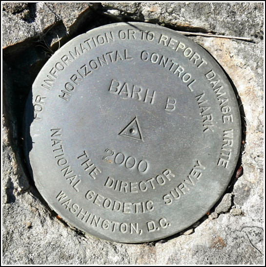
BARH B
Spatial/elevation data
| Coordinates | N 44.39335° W 68.221883° |
| Elevation | 94.37 ft. |
| Location | Maine
Hancock County Bar Harbor Quad |
Mark description
| Type | Horizontal Control Disk |
| Setting | Rock Outcrop |
| Monumented | 2000 by NGS |
| Description (NGS) | NGS Datasheet |
NGS recovery information
Descriptive text
Recovered in good condition.Narrative and photographs
On a morning filled with benchmark explorations, we stopped at the Bluenose Inn in Bar Harbor to look for the NGS disk BARH B that Rich found five years ago. For some reason we hadn’t yet come back so that I could recover it—but today was the day. We had no trouble finding it, and it is still in excellent condition and solid in its setting as it was when Rich found it.


(Recovered on September 9, 2002)
N 44° 23.600’ W 068° 13.315’
While vacationing on M.D.I. I decided to search for a few local benchmarks. This one, like many of the others I had hunted, was found during a very pleasant after-breakfast walk around town. Locating this mark was relatively easy using the historical description. At the station my Garmin GPSmap76 receiver indicated only 9 feet from the posted coordinates. The disc is quite visible and is in excellent condition. ~Rich in NEPA~


