TT15 WJK
Spatial/elevation data
| Coordinates | N 42.126332° W 75.64718° |
| Elevation | 950 ft. |
| Location | New York
Broome County Belden Quad |
Mark description
| Type | Reference Mark Disk |
| Setting | Square Concrete Monument |
| Monumented | 1942 by USGS |
| Description (NGS) | NGS Datasheet |
NGS recovery information
Descriptive text
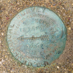
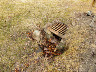
The station disk is a USGS reference mark disk, as described. The disk is in good condition, but the monument is set into soft ground within a foot of a drainage culvert. There is evidence of frequent ground erosion and it is likely that the monument is unstable.Narrative and photographs
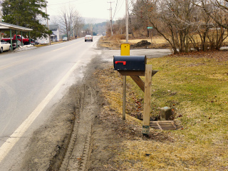
On our way north to Bainbridge we stopped to search for this USGS mark in Ouaquaga. “Search” is a bit of an exaggeration—it can be seen easily from the road. We’re not sure how to report the condition of this mark. The disk itself, and the monument, are in good condition, but the monument is set into very soft ground within a foot of a drainage culvert. There is evidence of frequent ground erosion. It seems likely that the ground is unstable here and the monument has moved. The concrete is bare on one side and the monument leans toward the culvert.
For some reason unknown to us, a reference mark disk was used. Dad and I took a look around to see whether there might be another mark that this was set in reference to, but we couldn’t find anything likely. Nothing is stated on the NGS datasheet; perhaps if we obtained the USGS datasheet, it would have more information. We have seen a few cases in which a reference mark or azimuth mark disk was used to monument a regular bench mark because it was all that was available at the time.


