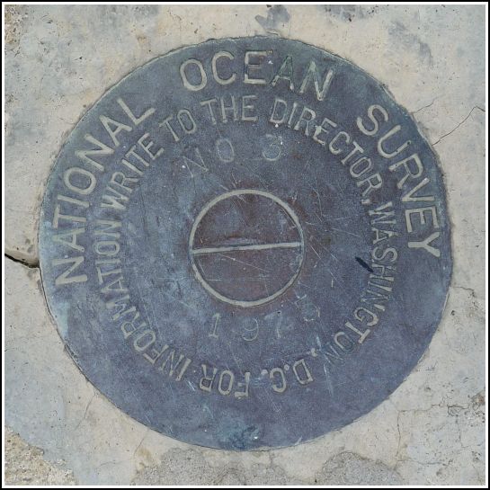
872 3868 TIDAL 3
Recovered in Good Condition on February 18, 2014
Spatial/elevation data
| Coordinates | N 24.842233° W 80.752483° |
| Elevation | 17.37 ft. |
| Location | Florida
Monroe County Long Key Quad |
Mark description
| Type | Tidal Bench Mark Disk |
| Setting | Bridge Wingwall |
| Monumented | 1975 by National Ocean Service |
| Description (NGS) | NGS Datasheet |
NGS recovery information
Descriptive text
Recovered in good condition.Narrative and photographs
We continued along the old bridge over Channel #2, after finding two benchmarks at the northeastern end, and found another one at the southwestern end! This tidal disk was also in very good condition and was an easy find on the curb of the bridge. The old bridge now serves as part of the Heritage Trail and is used for recreational purposes. Vehicle traffic uses the new bridge just to the south.


