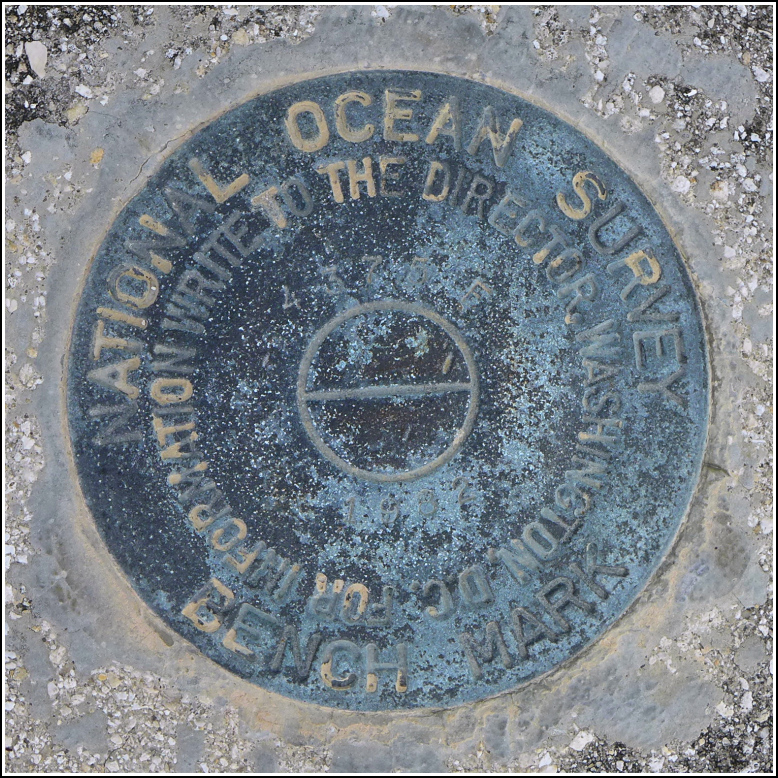
872 4375 F TIDAL
Recovered in Good Condition on February 20, 2016
Spatial/elevation data
| Coordinates | N 24.6036° W 81.57062° |
| Elevation | 12.98 ft. |
| Location | Florida
Monroe County Saddlebunch Keys Quad |
Mark description
| Type | Bench Mark Disk |
| Setting | Bridge Bannister |
| Monumented | 1982 by Florida Dept. of Natural Resources |
| Description (NGS) | NGS Datasheet |
NGS recovery information
Descriptive text
Recovered in good condition.Narrative and photographs
While on our way to check out the abandoned section of Old State Route 4A, which is a little-known part of the Key Deer Refuge, we stopped at the bridge over Sugarloaf Creek to check for benchmarks. We found F TIDAL at the eastern end of the bridge, set in the southern curb. The disk is in good condition and is stable, but the stamping is very difficult to read.


