P 69 RESET
Spatial/elevation data
| Coordinates | N 24.803066° W 80.85055° |
| Elevation | 17.10 ft. |
| Location | Florida
Monroe County Long Key Quad |
Mark description
| Type | Bench Mark Disk |
| Setting | Bridge Wingwall |
| Monumented | 1936 by NGS |
| Description (NGS) | NGS Datasheet |
NGS recovery information
Descriptive text
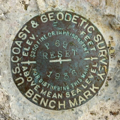
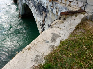
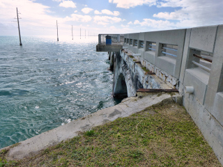
Recovered in good condition. The mark is located on the southeast wingwall at the eastern end of the old Long Key Viaduct, which is now a fishing pier and part of the Florida Keys Overseas Heritage Trail. The current U.S. Route 1 bridge is directly north of the old bridge.Narrative and photographs
At the eastern end of the Long Key Viaduct, Rich and I found yet another NGS benchmark disk! P 69 RESET was easy to find near the top of the old bridge wingwall, which has seen better days. Interestingly, the datasheet mentions a wooden walkway that once ran along the southeast side of the bridge. At one point the mark was directly beneath this walkway, and in order to use the mark, the board directly above it would have to be moved (not great planning on the part of someone?). Now, though, there’s no sign of the walkway. It would have been very interesting to see what it looked like and how far it extended.
The disk is in very good condition and although the edges of the wingwall are crumbling in some spots, it’s still stable.


