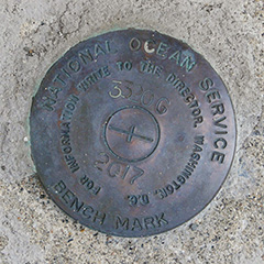
841 3320 G
Spatial/elevation data
| Coordinates | N 44.391616° W 68.20645° |
| Elevation | Unknown |
| Location | Maine
Hancock County Bar Harbor Quad |
Mark description
| Type | Tidal Bench Mark Disk |
| Setting | Concrete Seawall |
| Monumented | 2017 by National Ocean Service |
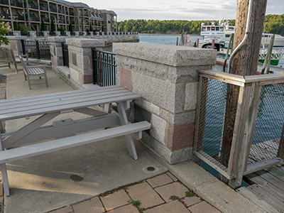
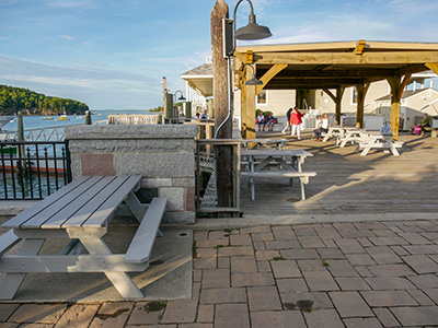
| Description (National Ocean Service) | The bench mark is a brass disk set in the top of the massive sea wall behind the Harborside Hotel and Spa, 17.9 m (58.7 ft) SE of a metal gate leading onto the hotel property, 7.7 m (25.3 ft) east of the eastern edge of the bathroom building, 6 m (19.7 ft) NW of the nose of a whale sculpture, and 2 m (6.6 ft) east of the eastern edge of the concrete and rock wall on top of the sea wall. |
Narrative and photographs
On our first night in Bar Harbor, we went for pizza at Rosalie’s as is our tradition. It was a warm evening, so after eating we took a walk on the waterfront and explored the cluster of small tourist-centered buildings at the marina across from the West Street Hotel. We called it “Disneyland” because of the preponderance of bright colors and overall cutesy appearance.
While wandering it crossed my mind that we had never really explored here before, and I wondered if there might be another tidal benchmark in the area that we were unaware of. A minute later, to our great surprise, we came across 3320 TIDAL G! It was set in 2017, which explains why we didn’t know about it before. It’s good to know that these marks are still of enough value that a new one was set just last year! It is in good condition.


