51 CH
Spatial/elevation data
| Coordinates | N 41.28049° W 76.24736° (estimate) |
| Elevation | 1316.325 ft. |
| Location | Pennsylvania
Luzerne County Sweet Valley Quad |
Mark description
| Type | Bench Mark Disk |
| Setting | Rock Outcrop |
| Monumented | 1942 by USGS |
| Description (USGS) | Red Rock, 2.4 mi E.; thence 1.7 mi S.; in front yard of Bethel M.E. Church; 130 ft N. and 20 ft E. from junction of Y-rd.; in rock outcrop; standard tablet stamped “51 CH 1942” |
Narrative and photographs
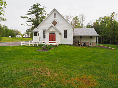
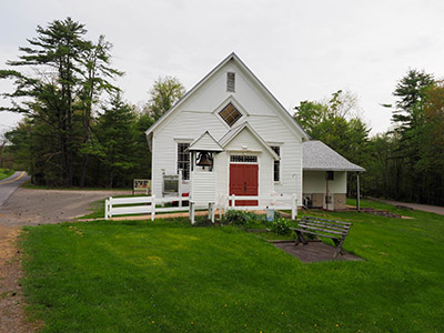
This was the second mark I attempted to locate on this cool, cloudy Death Hike day. After an early success at 58 CH nearby, I had high hopes for this one, but I had no luck here. There is no sign of a rock outcrop in the church yard; the yard is level and fully covered with grass. There were a few rocks poking out from beneath the grass that I suppose could have been part of a subsurface outcrop, but even if so, there would be no way to recover this mark without digging up the lawn.


