40 DSW
Spatial/elevation data
| Coordinates | N 41.419238° W 75.463908° (estimate) |
| Elevation | 1484.006 ft. |
| Location | Pennsylvania
Lackawanna County Lake Ariel Quad |
Mark description
| Type | Bench Mark Disk |
| Setting | Bridge Wingwall |
| Monumented | 1963 by USGS |
| Description (USGS) | Saco, 1.5 mi N. of; on macadam rd. leading to Maplewood; 8 ft N. of and above level with center of bridge; in NE. wingwall of concrete bridge over W. branch of Lake Wallenpaupack Creek; standard tablet stamped “40 DSW 1963 1484” |
Narrative and photographs
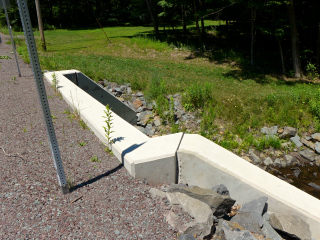
Rich and I usually spend a few hours each 4th of July at a picnic at Lake Spangenberg. For the last few years I’ve selected a few bench marks to look for along the way. 40 DSW was our first target this year. I had my doubts that it would still be in place, because a few years ago most of the small bridges in this area were washed out in a flood and subsequently replaced. As usual, we checked the satellite imagery ahead of time, and it seemed to show a new bridge in this area. Our suspicions were confirmed today when we checked out the site in person. I had expected to find a new PennDOT control mark set in the new bridge, as seems to be customary for each bridge that’s replaced, but as of today, this bridge is devoid of all survey marks.

