38 DSW
Spatial/elevation data
| Coordinates | N 41.442062° W 75.399469° (estimate) |
| Elevation | 1603.106 ft. |
| Location | Pennsylvania
Lackawanna County Lake Ariel Quad |
Mark description
| Type | Bench Mark Disk |
| Setting | Concrete Post |
| Monumented | 1963 by USGS |
| Description (USGS) | Lake Ariel, 1.0 mi E. of;, along macadam rd. to Tresslers Corner, thence about 0. mi S. along State Highway 196 to junction of T-rd. W.; in concrete post projecting about 0.5 ft above ground; standard tablet stamped “38 DSW 1963 1603” |
Narrative and photographs
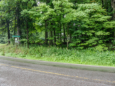
Today’s rain kept us from two of the four marks we had planned to look for, but at least we had a chance to search for this one (38 DSW) and nearby 37 DSW in Lake Ariel. We found 37 DSW but weren’t so lucky with 38 DSW.
The mark is probably still in place, but the area is heavily overgrown and I couldn’t spot a boulder anywhere among the vegetation. Given the likelihood of ticks and poison ivy, I didn’t want to wade through the weeds to get a closer look. We’ll try again in winter.

