2062 TBY
Spatial/elevation data
| Coordinates | N 41.23763° W 75.47469° |
| Elevation | 2063.645 ft. |
| Location | Pennsylvania
Wayne County Tobyhanna Quad |
Mark description
| Type | Bench Mark Disk |
| Setting | Rock Outcrop |
| Monumented | 1917 or 1921 by USGS |
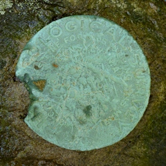
| Description (USGS) | Gouldsboro, about 1.4 mi SW. of; on bare rock summit known as Prospect Rock; just N. of Monroe-Wayne County line; about 1.0 mi NE. of Lackawanna Trail; in 6- by 5- by 2-ft rock; standard tablet stamped “2062 TBY” |
Narrative and photographs
I wasn’t aware of it last week when we came to Gouldsboro in search of WANNA, but there is a bench mark atop Prospect Rock in the park. It’s not shown on any recent topo maps; in fact, the only map I could find that shows the mark is the 1921 Tobyhanna quad from the Maptech/MyTopo historical topographic maps collection. This is the reason we were initially unaware of the mark. I was intrigued by the “prospect” of hiking the Prospect Rock Trail and searching for this mark, so we decided to return. My father was interested too; Rich and I had even been talking on Monday about how much my father would have liked this area and the old Highway 611 trail, so the plan for the day just came together nicely.
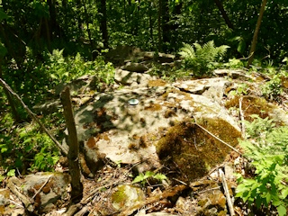
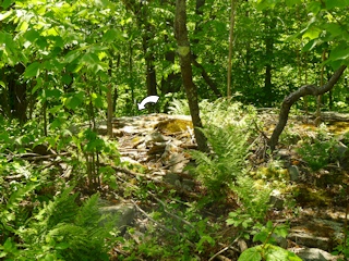
I had estimated coordinates from one of the maps (actually not the topo map that showed the bench mark) so we hiked toward them, but I had plenty of doubts about how close they would be and if we even stood a chance of finding the mark in this jungle. At about 75 feet from our estimated coordinates we came upon a vertical rock ledge and above it a “summit” that, while far from being bare, was easily recognizable as having been a bare rock summit at some point. The three of us split up to search and within 30 seconds, Rich exclaimed “Here it is!” He had found the bench mark on a large boulder just about ten feet southwest of the current route of the trail. Mostly by coincidence and luck, I’m sure, the mark was within 35 feet of the very approximate coordinates I had determined beforehand.
The disk is an old style, thick (“cookie-like”) USGS Bench Mark Disk. It is in fair condition, with many scratches on the surface and a few “bites” out of one side. I was easily able to read the elevation (2062) but could not see the “TBY” anywhere on the marred surface of the disk. Despite the cosmetic damage, the disk is very solid in its setting and the rock seems stable as well.


