2 W
Spatial/elevation data
| Coordinates | N 41.917399° W 75.85116° (estimate) |
| Elevation | 1118.030 ft. |
| Location | Pennsylvania
Susquehanna County Franklin Forks Quad |
Mark description
| Type | Bench Mark Disk |
| Setting | Concrete Base |
| Monumented | 1942 by USGS |
| Description (USGS) | Franklin Forks, 0.2 mi W. of State Highway 29; on W. side of stream; 45 ft W. of rd. forks; in concrete base of guardrail post; standard tablet stamped “2 W 1942 1118” |
Narrative and photographs
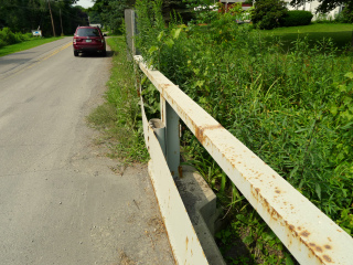
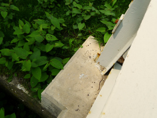
2 W was the first mark we had planned to look for on our way to Salt Springs State Park. The description specifies only that the mark is west of the stream, although the topo map shows the mark near the northwest corner of the bridge. The situation looked promising when we arrived—the rusty guardrail seemed to indicate that the bridge was untouched for decades. Unfortunately for us, it looks like the bridge deck was repaired and new concrete was poured over the existing foundations, including the guardrail post bases. The date “2011” is scratched into the concrete at the southwest corner of the bridge. We checked all corners and both sides of the bridge, but found no sign of the disk.


